Saturday, April 19, 2014

Good Will To Travelers


The Skykomish River ran high and wild with cold rain.
Shivery as I was in the early morning, it was a pleasure to behold the thundering rapids and the foam leaping up from boulders.
I shook my fist at the raging waters as I looked down on them from a bridge.
“I loveya, you crazy river!” I shouted.
So did locals apparently. Many of them had plastered bumper stickers on the back of their rides, speaking out against a dam proposal.
I had a good feeling about being on the west side of the Cascades.
In the past couple of days I had biked through Coulee City, Washington, crossed the rolling Columbia River, stayed with my buddy in Wenatchee, then climbed from 780 feet to the top of 4,060-foot Stevens Pass where my bike tires touched snow for the first time on the trip. I made great time bombing down the other side, though I was thoroughly chilled by the time the road leveled. I spent a night with my tent pitched beneath some enormous trees along the highway. There were some perfectly good Forest Service campgrounds nearby, but all of them were closed due to the federal government shutdown. Washington State was many miles from Washington D.C., but not far enough to escape the stupidity of its leaders.
The gates were drawn over the entrance to the campgrounds. Later, I’d read that the Sheriff’s department had gone into the campsites and removed the campers who’d stayed in place in defiance of the rules (I’d come close to camping there myself.) I thought it was funny that the Sheriff’s department had done the removals instead of the Forest Service, but then again those employees weren’t drawing a paycheck now. The Forest Service office I passed nearby was closed up with a sad message taped to the door explaining that they couldn’t help anyone as long as their funding was dried up. I can’t fault the rangers for not volunteering to throw out campers on their own time.

There was a small café down the road done up like a Bavarian cottage. “PCT Hikers Welcome,” a sign announced.
The café was only a dozen or so miles from where the Pacific Crest Trail goes over Stevens Pass. The pass was just over 100 miles from the Canadian border — the end of the line for the hikers who had spent about half a year hiking up from Mexico through California, Oregon and Washington. I wondered if any of them were around.
Sure enough, when I walked through the door, I saw several bearded faces and well-worn outdoor apparel on the guys and girls alike. All of them looked fitter than the average folk that you see on the street. They looked like people who had been walking.
They had been walking — all the way from Mexico — but not so much over the last couple of days with all of the snow moving in over the Cascades. This I learned after introducing myself to several of the thru-hikers and warming myself over a big mug of coffee. I’d been on the road for a couple of weeks at this point; they’d been on the trail since the spring (it was the first week of October now.) My adventure was small fry compared to taking on the PCT.

Still, the group seemed happy for the company. They wolfed down enormous plates of pancakes and home fries. No wonder the café welcomed thru-hikers. They were good business.
It turned out that one of the guys was going to work at Gray Nob hut on New Hampshire’s Mt. Adams — one of my favorite mountains back east.
 Despite the laid-back atmosphere, the weather in the mountains was never far from anyone’s mind. The seasons were turning against the hikers. The snow in the passes would get deeper, the wind more treacherous, the cold more brutal. The trail to the north of Stevens Pass would probably be harder than anything they’d faced yet.
I’d already got a taste of the Cascades’ cold and wind at 4,000 feet on Stevens Pass. The trail would climb to 8,000 feet before it reached Canada.

I stepped out on the café porch to look at the cold drizzle coming through the pines. The Cascades rose straight up like knives, thrusting themselves into the low-lying clouds. It was sure to be blowing snow up there.
A large bearded guy had also stepped out on the porch, his face grim as he watched the spectacle unfolding thousands of feet above us. It was going to be a helluva hike to get to Canada I told him.
He agreed, though he wasn’t hiking the trail. In fact, he had devoted the last months to following the PCT hikers up from California. He met them at the trailheads in his truck, brought them food, helped some of them find work after they got off the trail and cheered them up when they were in the pits.
It felt like a calling to him, he said, in the same way that some people felt like they had a call to hike the trail. I nodded. Both the Pacific Crest Trail in the west and Appalachian Trail back east are known for their “trail angels,” people who go out of their way to help hikers. I’ve enjoyed a cold can of soda out of a crate that an angel left in mountain stream for passerby to enjoy; sometimes they give rides or let dirty hikers crash at their place for no charge. In this case, being a trail angel had become a way of life.
Now he was worried. Most of the hikers didn’t have the gear to take on the blizzard-type conditions or the deep snow that lay ahead. He had already heard horror stories of people not being able to make it through the drifts or flirting with hypothermia in the high passes.
They were so close, he said. I thought he might choke up. The café below Stevens Pass was probably the end of the trail for them, even after they’d managed to make it this far all the way up from Mexico. He had already scored some donated winter gear for the group, but it wasn’t likely that he would be able to scare up the thousands of dollars of clothing and equipment necessary to outfit everyone — especially not snowshoes, which can cost a couple hundred bucks a pop.
So that chapter in their lives would be over soon. It’d be over for him too. As much as he hated to see the hikers abandon their journey when they were so close to Canada, he was even more afraid that some of the hikers would try to take on the last miles without the right gear, risking injury or death.
I felt humbled by how much he cared about his charges, who were right behind us in the café, wolfing down pancakes and making plans.
As it happened, the trail angel helped me as well. I didn’t have any work lined up for after the trip, but found a farm gig through a website he recommended.
I enjoyed hanging around the PCT guys, but alas, my journey was not at an end having about 60 more miles to go until I reached my friend’s apartment in Seattle.

It is important to note that PCT hikers are not the only ones who benefit from acts of charity.
My free motel room in Davenport jumps to mind.
Later the next day, I was biking on a windy stretch of road east of Coulee City when a truck in the other lane did a U-turn and the driver pulled off the road. A guy in a U.S. Marines uniform with a blonde ponytail jumped out, holding something in a paper bag.
“Hey man! Where are you biking to?”
“Seattle from Utah,” I said.
“That is so cool! Hey do you want some cookies? My grandma made them for my birthday.”
I wanted the cookies. Technically, I had just become a vegan and they most likely had eggs and milk in them. Somehow, I just couldn’t bring myself to turn down this earnest young marine who u-turned in the middle of a busy highway to give his grandmother’s homemade cooking to a stranger.
“Thanks man!” I said.
 It crossed my mind that baked goods made in a state, which had recently legalized pot might contain other ingredients beside chocolate chips and peanut butter. It had been a long trip so far and I decided that anything offered with good intentions was fine by me.
“These look like great. What a great coincidence that he had vegan cookies right next to him while I was biking down the highway,” I lied to myself in a fit of shameless moral relativism.

The next day was another trial and saw me climbing two tall passes up from my campsite west of Coulee City.
I spent a couple of hours pedaling through whirling fog, feeling disoriented, discouraged and cold. Occasionally the sky would clear and I’d get a glance at a barren scrub landscape with red rock cliffs that reminded me of Utah.
The highlight of the ride was bombing down from a 2,000-foot pass down to the Columbia River at 700 feet. I would have hit the turns harder if it weren’t for the water on the road.
I followed the wide river waters the rest of the way to Wenatchee with the landscape dominated by apples and pears.
There was a park near the outskirts of town where I took my cell phone out of my pack and called my friend Jon. He knew I was coming to visit, but didn’t realize that I was biking.
“I was wondering why it took you so long to get here from Montana,” he said later.
Lucky me, I got a place to crash in his apartment and went for a night on the town in Wenatchee. 
For the first day on the trip, I didn’t pedal a lick.
I took most of the rest day off, heading out mid-afternoon to begin the climb up Stevens Pass. My initial plan to camp in the national forest that night sank when night fell and I was still on the highway. I turned into a KOA Kampground instead, where I paid the $27 fee like the sucker that I was.

At first, I didn’t think Stevens Pass would be such a big deal. It was only 4,000 feet, half as high as the 8,000-footer I’d tackled on the second day of the trip. No prob. A glance up at the imposing white wall of cliffs rising up to the west of me made me reconsider this position.
If a storm swooped in while I was still in the mountains, I’d be in for a rough time of things.
The climb was gradual but long. I got world class views of the Wenatchee River, with its crashing, reckless waters that mirrored the Skykomish on the west side of the pass. It was entertaining trying to figure out what line I would take if I was trying to navigate a kayak or a raft through the chaos.
I stopped at a rest area at around 2,000 feet to refill my water bottles. A big truck pulled in as I walked over to my bike, brimming with fresh-picked apples.
“Hey, help yourself if you want anything,” the driver told me.
I was more than happy to oblige, snatching a tasty golden delicious that was crisp and full of juice.
A few people asked me about where I was going with all the gear. When I explained the trip, most of them thought it sounded like a cool thing to do. In fact, it seemed like the further west I got, the more people seemed to think I was doing something worthwhile as opposed to deranged a la the “are you ill in the head?” woman that I met in Manila, Utah.
There were more thumbs ups on the road, and more acts of charity to keep me going, even as I felt like I was running out of steam.
Thankfully, the threat of storm never materialized and I made it over the pass just fine.
20 hours after I wiped the apple juice out of my beard, I was leaving the café and headed for Seattle.


Wednesday, April 16, 2014

The Dark Road, The Cop and The Free Room


      The sun was going down and I didn’t feel lucky.
About an hour ago, I’d taken a “shortcut” biking west out of Spokane, Washington and now I was mired on a hilly back road between endless grain fields, beginning to suspect that I was nowhere near where I wanted to be and not getting any nearer.
No, the road that I figured would take me south along a diagonal had turned in the opposite direction. I faced the unappetizing choice of continuing along a road that was going nowhere, or admitting that I’d screwed up and pedaling miles back the way I’d come. Also, where the hell was I going to camp?
As I pondered these possibilities, I heard an engine coming up from behind. A guy in a beater sedan wanted to know if I could point him to the Route 2. I laughed. You can’t make this stuff up.
The guy in the sedan decided to turn around. I decided he had the right idea.
I retraced two miles with the sun at my back, then turned onto a road headed due south. I didn’t know for sure if it was going where it needed to, but didn’t have the stomach to go all the way back to Spokane.
Where to camp? Where to camp? The next town probably didn’t have a camp area. So I’d camp in the woods then. Only there were no woods.
If not for distant mountains, the landscape could have been mistaken for Iowa. Everything was someone’s farm — tilled soil where a marauding ninja camper would be in plain sight (or the gun sites) of an irate farmer.
I ate the rest of my snack food in a gulp of sesame seeds. Still hungry. Still exhausted. Still nowhere near where I needed to be.
The cars had their headlights on when I finally got back on Route 2. I had several miles before I got to the probably camp-less town of Reardon.
No, make that the definitely camp-less town of Reardon. I sagged into a booth in the fast-food joint. The teen behind the counter there didn’t know about any camps in Reardon, but thought there might be some in Davenport, a mere 10 weary miles through the darkness ahead. At least there was a decent-sized margin on Route 2, but I was still less-than thrilled about having 65 mph traffic flying by me in the dark
I ate French-fries joylessly and sucked down cola.
      After I’d finished and paid, I stepped outside to embrace the suckitude of my situation. There was a reflective vest in my dry bag and I strapped it to the back so I would be more visible to oncoming headlights. I’d have felt far safer if I had invested in a blinking taillight, but like so many things on this trip, I’d voted for thrift above comfort, sometimes safety.

Fortunately, the traffic was sparse along the highway. Every time a car went by, my shadow started out long and straight in front of me, then rapidly shrank and whirled to the side as the headlights drew closer. Sometimes it would feel like I was moving backwards. Fortunately, the wind from earlier had dropped and it hadn’t gotten bitter cold yet. I pedaled furiously from one mile mark to the next, until I finally reached the edge of Davenport.
The town was dark and empty. I took a quick swing down Main Street where there were no signs for state parks or public camping. I decided to see about the motel/ RV park near the edge of town.
As luck would have it, the motel manager was walking up to his door when I pulled my bike up. Could I set up tent in an RV site?
He thought about it.
He normally didn’t let people tent camp because he had no bathrooms outside. RVers could do their business and flush their wastewater directly into the septic systems.
Well, I probably wouldn’t have to take a dump that evening, if that was what he was worrying about. I’d make sure to urinate in the empty lot across the street so that it wouldn’t be his problem.
I could tell the guy wanted to get to bed and wasn’t interested in staying up talking for much longer.
Finally, he acquiesced and said I could put a tent up near the side of the motel.

I dropped my bike near an antique wagon outside and crossed the street to take a leak. It was a relief to have a place to stay — and a relief to relieve myself for that matter. Midway through the stream, I became aware of a light shining in my face. That light was coming from a cop car.
I quickly hid the offending object and shot the officer a cheerful wave. I began to walk away quickly but casually. Hopefully, I’d lose track of him between the RV’s. I rounded the corner of the motel to find myself face to face with the motel manager.
“Was that the cops?” he asked.
 I told him it was.
“Here” he said, and produced a key from his pocket.
I’d be welcome to crash in an extra room, he said.
It was music to my ears.
We went back together and got the bike (I made sure to give the cop another polite wave) and I wheeled it into the room. There would be no charge, the manager said. Then he left and I shut the door.
Standing in the immaculate room with its plush bed and quaint railroad paintings, I felt a bit like Dave Bowman in “2001 a Space Odyssey,” who emerges into a similarly incongruous room inside an alien sun after he emerges from an extra-dimensional voyage through a monolith.
In lieu of Bowman’s orange spacesuit, I had my black rain jacket, oversize dry bag and bristling wild man beard, which were slightly less out of place.
I shed my layers and went for the shower — the first in almost 300 miles.

Thursday, April 3, 2014

Wet roads and wind


The brightest orange
Is the highway median
Laid out on wet pavement
Beneath autumn leaves.

          ------------

Clouds of gray drift in
Above still-green birches
Of the bitterroots
To wash away the summer.

                ------------

“REG. 3.07”
The sign flashes red and green
Outside Ron’s Gas and Go
As the trucks push on
To Kootenai National Forest
In clouds of dirty mist.


The hours of wet, cold and monotony are fine times for philosophizing and poetic musings. I’m in a better mood when the sun is out and the road is easy, but I can only go so far exulting over beautiful sunrises and pristine landscapes before the writing gets damn boring.
So now that I’m sitting comfortable in a warm, dry place, I’ll go ahead and thank Mother Nature for being such a burr in my ass in the days that I pedaled out of Northwest Montana, across the Idaho panhandle into eastern Washington.
I got to enjoy about 12 miles of steady biking after I left my campsite north of Missoula before the brutal wind set in. It was like someone had put superglue on my tires. I could crank for all I was worth and go maybe a mile an hour faster.
Highway 200 follows the wide and blue waters of the Clark Fork through pastureland and stands of conifers. The wind kicked up whitecaps on the river, meeting the rain-swollen flow head-on. Unfortunately, the thousands of cubic feet of flowing water were much better equipped to resist the blustery air than I was.

I hadn’t packed enough water. The Clark Fork was a tempting refill option, but I was reluctant given the number of farms in the area. Eventually, I pulled up at a farm stand that was closing down for the season.
I asked a guy loading stuff into his pickup if he had a hose out back.
“There’s a spring down the road,” he told me. “It’s the best water in the world.”
The water ran out from a faucet in a rock wall beside the tracks.
A BNSF train thundered by as I filled my bottles. I took a drink. Indeed, the water was pure, almost sweet.
A truck pulled up with a bunch of empty jugs. I got moving again.

The wind let up a bit by the afternoon, allowing me to finish the day with about 75 miles of progress. I did an additional four miles of pedaling to get to my campsite, located along a tributary. A sign said that there was potential chemical contamination in the water, so I skipped the boiled pasta dinner I’d planned for myself.
I was the only person in camp excepting for an RV parked at the other end.
That changed around 8 p.m. at night when an SUV pulled up about 100 feet from my tent.
I peered out and saw the guy in the cab. A light was on, like he was reading something. I was a little annoyed, but figured he’d drive off soon enough. I made note of my bear spray nearby. If he was thinking about doing a little axe murdering he’d get a face-full of capsaicin. 

I felt a certain reluctance to go to sleep with the truck out there and its little light. Finally, I decided I had to see what was up. I walked over and waved through the window. The guy waved back.
I introduced myself and asked how he was doing.
He was out of the house because he’d been in an argument with his girlfriend and didn’t feel like staying at her place. The argument had been going for a couple days, he said, and he’d been parking in the same spot where my I’d set up the tent.
We talked for a while about different parts of the west where we had traveled. It turned out that he had rafted the same section of the Green River that I had guided that summer.
I was reasonably convinced that he was not the axe murdering type and went back to the tent.

There was a cold drizzle the next morning. On the way back from the campground’s outhouse, I saw the guy walking outside with a handgun holstered at his belt (for the bears, he said.)
I started down the road again with numb fingers. Double dump trucks and logging rigs flew by, kicking trails of spray up off the pavement. The Clark Fork was a dead fish gray under the rain-swollen sky.
I crossed into Idaho for the third time on the trip and kept going to the massive Lake Pend Oreille, whose shoreline I’d be following for almost a day.
The map showed me a campground that was about a mile and a half out on a peninsula. When I got there, I found that it had just closed for the summer. I ended up camping on some public land on a wooded hill across the street.

I went into Sandpoint the next day, a city that my Rand McNally atlas identified as the most beautiful small town in the U.S. Much of the scenery, such as views across the lake, was shrouded in the fog. Traffic was busy along the narrow road and made for a harrowing pedaling until I got to the bike paths.
I splurged on some hash browns and hot coffee in town then peddled across the lake on a two-mile long highway bridge. When I got to the other side, I realized I’d been going the wrong way. Rather than face a stiff headwind, I decided to go on the south side of the lake and rejoin my course near the Washington border.
One disadvantage of this plan was that the south side of the lake turned out to be relentlessly hilly. I was exhausted by the time that I got back on course.
Finally, I got back on the main road and crossed the border to Washington. The area was wooded and it was easy to find a tent stop. It would only be a couple days until I got to visit friends in Wenatchee and Seattle. Now that I was out of the mountain states, I figured there would be easier going and looked forward to some more leisurely days ahead. I soon found out that Washington would have plenty of challenges of its own to throw at me. 

Thursday, March 20, 2014

The Day I Should Have Had In Missoula


The University of Montana M as seen above campus. This photo is not from my bike trip, but rather from my earlier visit to Missoula. You don't get to see any new pictures of Missoula because my camera got busted.
The day I should have had in Missoula would have started with me waking up to a perfect sunrise above my campsite, not a freezing fog.
If it were that perfect day, I would have pondered the ethereal beauty of the moment and felt reassured that my bike trip was a chance to reconnect with simple pleasures that most people divorce themselves from as they go about their day-to-day lives.
Then I would take my camera out from a dry place, where it hadn’t been drenched by rain that soaked into my partially collapsed tent, to take a memorable picture of the moment. If it had been my perfect day in Missoula, my camera wouldn’t have been busted forever, and I would have plenty of stunning pictures to post from the rest of my trip.
On the day I should have had in Missoula, I would have cooked myself a hardy breakfast off my stove, not  grudgingly swallowed peanuts and bread. Nor would I have dreaded the 20-something miles I had to pedal to get into town.
No. On my perfect day in Missoula, I would have felt energized and inspired by the distance I’d traveled so far.
Both my real and ideal days share my goal of kicking back a little. I'd  have a beer with a good plate of food and mingle with those fixie-riding hipsters who populate the town, even if I'd normally ridicule them for being fixie-riding hipsters.

Both my fantasy day in Missoula and the day I actually had would be colored by the fact that this was a place I’d visited senior year in college when my thesis on contemporary Irish lit was the center of my world. I got a free ticket to present my work at the National Collegiate Undergraduate Research convention at the University of Montana.
Right after I finished speaking, I decided to do the hike up the hill to the university’s famous concrete “M.” Then I kept going to the top of the 5,000-foot Mount Sentinel in my khakis, tie and loafers. It hadn’t been so great for the clothes, but it’d been a great time.
If I’d had my perfect day in Missoula, I’d have done the hike again just for kicks, not call it off on account of rain and that I had other stuff on the to-do list.

If it had been the day I should have had in Missoula, the county would have finished the bike path going all the way to town and I wouldn’t have ended up riding in the highway margin again with traffic kicking up spray.
If that sounds like too much to wish for, I’ll dial it back and say that I wish I’d shown up any other day of the week but Sunday.
Then when I happened upon the Adventure Cycling Association’s national headquarters on East Pine Street, I would have gotten solid advice about the roads ahead, maybe even bought one of their guides, which would have information about where to camp and other stuff that would have helped in the days ahead.
On my actual day in Missoula, the headquarters was closed, but at least they had a map that listed bike shops and breweries that I could hit in town.
I peddled through the cold and tragically real drizzle to a bike shop that was closed (surprise!) on a Sunday. Another bike shop was open, but not fully staffed for the weekend and didn’t have the time to give to my gears, squeaky axle and worn-down brakes.

On my perfect day, I wouldn’t have lost my balance at an intersection and struggled to pick my fully-loaded bike off the pavement in front of cars at a green light.
Hipsters wouldn’t be able to pedal bicycles faster than me.
I would get a beer and sit outside in warm weather, not shivering inside drinking my beverage out of a sense of duty as opposed to real pleasure. The place would have served delicious French fries and veggie burgers — not just bar peanuts, which I shoveled down in vast quantities anyway.

I would have stayed in town if it had been my perfect day. I might have dished out the money to be at the local KOA, maybe couch-surfed somewhere.
Even if I had left town, I wouldn’t have taken a wrong turn that lead to an on-ramp for I-90, then said “the hell with it,” and ended up peddling four miles in the break-down lane of a busy thoroughfare.
It wouldn’t have been getting dark as I was climbing that massive hill into the Flathead Reservation. It wouldn’t have been pitch dark when I got into Arlee. I would have bought some blinking gear at one of the bike shops so cars would see me. I wouldn’t have had to pedal two more miles on the dark road before I got to the campsite.
I wouldn’t be so negative all the time.


Even though it wasn’t my perfect day in town, the following was kind of cool:

*A bunch of people in their early twenties cheered for me when I was on the bridge above the Clark Fork. “We saw you in Darby yesterday man! Keep going! You rock!” I went a high-five that almost swerved me into the path of an oncoming van. It was pretty sweet.

* The Adventure Cycling Association did leave useful paper maps for visitors. I used mine to find the brewery and try (unsuccessfully) to get my bike fixed up.

*Though I might have enjoyed the beer more in better circumstances, it was still the best I had on the trip that far. (The other beer was the baby spit lager I’d drunk in Idaho.)

* A guy in a car gave me a thumbs up as I was climbing uphill toward the Flathead Reservation.

* I arrived at camp late, but no-one ran me over. I was a big fan of the warm showers and that no one was up collecting fees at that hour.

Monday, March 17, 2014

Across the Bitterroots


Moon over my camp south of Lost Trail Pass

I didn’t feel half bad considering that I’d pedaled 100 miles the day before.
It was another shivery morning, but I was able to spare myself some suffering by warming my hands in an electric drier inside the camp bathroom. Spoiled.
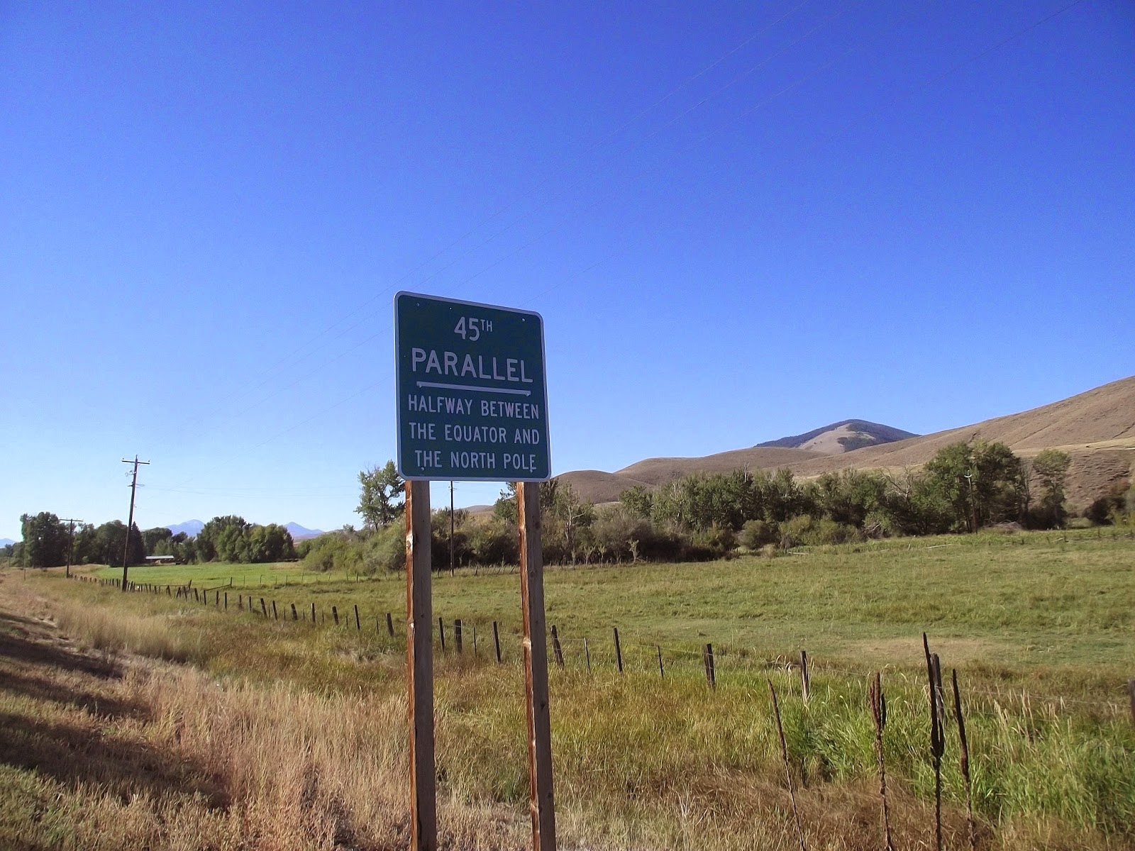
I definitely felt stiff as I got back on the bike but the air was invigorating. The road followed a riparian zone of trees and farmland below the sparse, arid hills above. In a few miles, I came upon a sign marking the 45th parallel — exactly halfway between the equator and the North Pole. It brought me back to childhood summers in Rangeley, Maine, which happens to be at the same latitude and has a colorful sign up outside of the Pine Tree Frosty to mark the invisible line.
While Rangeley was a couple thousand miles to the east of me, I was excited to pull into Salmon, Idaho, which I’d already heard stories about over the summer. Specifically, I’d heard about the Salmon River, a.k.a The River of No Return, with its hardcore whitewater. I’d join fellow raft guides around someone’s laptop and watch hours of rafts and kayaks going up against the massive waves, rocks and keeper holes, often getting stranded, flipped and generally carned-out by the river’s fury.
I counted down the mile marks to Salmon with growing anticipation. My priorities included buying some real food at a grocery store, and maybe grabbing some Internet time for myself as well.
Going back on the busy roads was a bit of a shock after having minimal traffic for over a hundred miles. Cities also tend to have steeper hills than wussy highway grades, so I found myself puffing hard to get to the supermarket, which was maybe a hundred feet of climb from the river in the center of town.

I'm always crossing the line
I loaded up way more food than I needed and set off for a quiet riverside park where I could gorge myself in peace.
I discovered that my brakes were getting worn when I went back down the hill and found that it took much longer than it should have to come to a complete stop at an intersection. It occurred to me that this might be something I’d want to look at before I went down the next mountain pass.
That was, if I could make myself stay in town that long.
Being amongst civilization again was disorienting rather than reassuring. Suddenly, I couldn’t just take a leak wherever. I had to worry about colliding with people and vehicles again. I felt self-conscious about my oddball bike rig with all the gear hanging off as well as my scraggly appearance. I sat alone at a picnic table by the river where I ate more food than most people go through in a day.
It was about 45 miles to reach the Montana border in the north. I didn’t know if I’d be able to make it over the 7,000-foot Lost Trail Pass that day, but I was already feeling restless with the time that I’d spent in town. I decided to skip the library or finding a good bike shop in town. It could wait until Missoula.

Salmon River, looking north toward the Bitterroot Mountains
I left town under a broiling sun, feeling bloated and lethargic after the picnic table food binge.
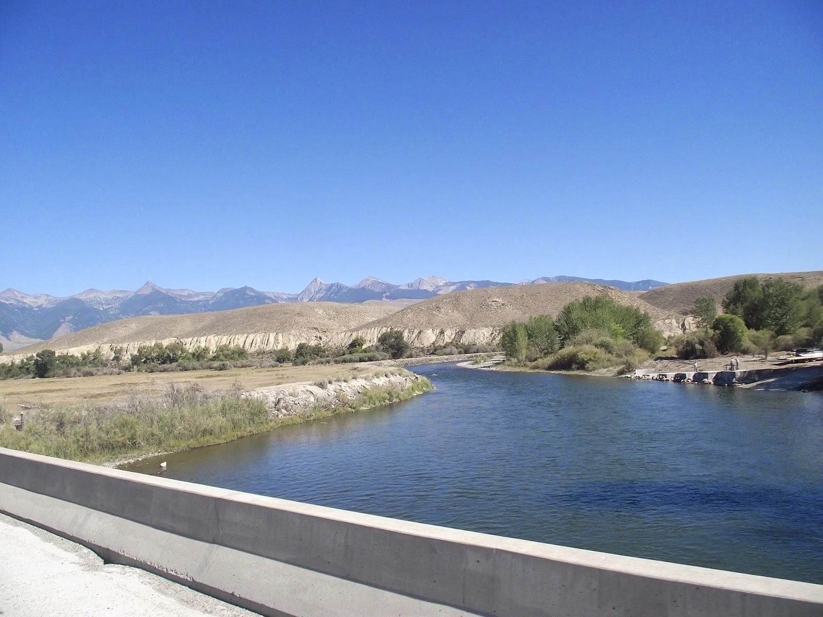
The Salmon River was a beautiful traveling companion. It wound blue and sparkling through the dry hills and canyon cliffs. I’d see fly fishermen here and there standing out in waders. One thing I didn’t see was Epic River Carnage: no massive standing waves or homicidal cataracts. The most adrenaline I could see in this section was little fast water riffles, which would barely make Class I.
Every once in a while, I’d see the familiar sight of a trailer loaded down with rafts, but none of them were in the water. The good stuff must have been somewhere else.

Landscape shot near the Salmon River

My showdown with the Bitterroot Mountains started with a gradual incline on the way to Lost Pass at the Montana border. For several miles, I kept going up steadily. I stopped at a couple historical signs to catch my breath and get water. The Lewis and Clark Expedition had been in the neighborhood when they’d crossed the Continental Divide. Being on a known map and more or less contained within civilization, I felt a bit coiffed compared to these grizzled historic forebears. No doubt, Meriwether Lewis had smelled a fair stretch worse than I did at this point in his expedition.
Camping looked like it might be an issue. The road was hemmed in by private summerhouses, which made me worry about finding find a tent site without trespassing.
The got steeper, and soon I was in low gear standing up on the pedals. The road switched back again, and again. When was I going to be in Montana?
As tired as I was, I still thought I might be able to crank it the rest of the way up the pass by nightfall. I even went past a turnoff to a national forest campground so that I could make more distance. After a couple more miles of grinding uphill struggle, I decided that Montana could wait another day. I'd done close to 80 miles.
The best place I could find that wasn’t on an impossibly steep slope or in someone’s backyard was a patch of forest in the edge of a new subdivision. I dragged my bike over a guardrail and guided it past the trees with plastic ribbons around their trunks. In another year, my tent-site might be the living room for yet another roadside mcmansion.

I started the next morning with a five-mile grind up to the 7,000-foot Lost Trail Pass into Montana. Each time I got to the top of a switchback, I expected to see the top — only to see more road winding up ahead of me.
Several drivers coming down from Montana shot me thumbs-ups and gave me inspirational honks. It was late morning by the time I reached the crest of the hill.
There was a visitor station and a small ski resort set up on the border. If I’d have wanted to bike a couple miles out of my way, I could have made it to the Continental Divide, but decided I’d rather use that time to get closer to Missoula, which was 90 miles to the north.
One important priority I took care of was checking my brakes. I adjusted the clamps so that even if they weren’t the best, they would put out enough drag so I could slow down and steer myself out of trouble. I practiced stopping a couple times, took a deep breath, and then started down the other side of the pass.

Finally!
The rhythm of the wheels turning blurred into a constant thrum and I felt my eyes tearing up in the wind. I didn’t turn a pedal, but every muscle was clenched as I flew down the curves. It was awesome.
I tried to use the brakes as little as possible. I leaned hard on the curves (though maybe not as hard as I would have if I’d been riding without gear.) Sometimes, I let myself drift over center line in order to make a turn. Every gram of my concentration was locked on the asphalt stretch in front of me, the dashes on the pavement coming at me slowly at first, than speeding up, finally rushing past in a blur of gray and yellow.

The mountain forests gave way to farmland. I’d gone through 10 miles without pedaling a whit. The next four miles were a more gradual downhill and I barely worked at all.
The road eventually flattened out to a scenic ride along the Clark Fork River. The Bitterroot Mountains towered to the west.
One thing that I wasn’t a fan of was the traffic. Vehicles coming and going from their ranches and vacation houses flew by my left side. There was precious little margin to work with and it cut into my enjoyment.
As I worked my way further north, I found bigger towns with strip malls and cars backed up with stoplights.
Fortunately, there was an intermittent bike trail that let me avoid some of the mayhem. Even so, I found a tough wind that started shoving me around. I started to slow down.
It got later and later in the afternoon, and all I could find was commercial development and nothing that was available for camping without going way off course. It'd been about 85 miles so far. I was so tired that it was turning into a colossal effort just to go another mile

Bitterroot Mountains as seen from Montana
.
Finally, I took a road to a recreation area in a canyon to the west. There was no camping allowed, a sign explained. Well, screw it.

I trundled my bike up steep bluff where I hoped it would stay out of sight and set to getting my tent set up. Of course, as soon as I set to work, I saw a couple hikers coming down the other side.
I sort of shrugged my shoulders at what I was doing. They moved on. I didn’t think they were about to turn me in.
Finally, I threw my bag inside my tent and fell into the sleep of the dead. 

Camp: undisclosed location, south of Missoula

100-Mile Push for Salmon

The road toward Salmon going through the Idaho National Laboratory (Sept. 2013)

My hands were so cold I could barely make myself enjoy the sight of the sunbeams playing along the mist rising off the Snake River nearby.
It was another shivery, dew-drenched morning. I walked out onto a dock, dipped my pot into the fetid water with its gray floaties and set about making oatmeal. My numb fingers barely worked the stove.
If there was something to be grateful for, it was that there was no wind. It would be relatively flat going today. With any luck, I would be able to make a good part of the journey to Salmon, Idaho, another 145 miles ahead of me. Towns, camping and water would be few and far between.

I pedaled out from my campsite wearing several layers and heavy mittens, peddling hard for warmth. I veered across some railroad tracks and through the tiny burg of Roberts, Idaho where I’d bought beer the day before.
A mile later, I went over I-15. A local had suggested some back roads that I could take north, instead of peddling in the highway breakdown lane. The route didn’t appear on my map, so I was going on faith that I would eventually intersect Highway 28 after 12 miles and be on the right track.
The landscape was farm after farm, most of it had been harvested recently, so they were acres of nubs. 20-foot stacks of straw bales flanked the massive parcels, like buttresses against an attack. I could look across the fields to the traffic on I-25. Beyond lay snow-capped mountains to the northeast.
Hawks wheeled in the blue sky, searching for voles or field mice.

Tent site by the Snake River
By the time I hit Highway 28, I was feeling warmed up and in a pretty good groove. The sun chased off the morning chills as it climbed higher. I flew past Terreton without stopping, but pulled up at a convenience store in Mud Lake to refill water and satisfy a junk food itch.
Only a week into my trip, I was already beginning to develop a disturbing pattern around gas stations. It was easy to leave my bike unlocked outside where I could see it, go in and spend cash on some plastic-wrapped commodity, bombing my body with simple sugar and fat. Usually the stuff was overpriced too.
Even when there was a supermarket on the relatively isolated route I’d chosen, such stops cost time. I felt wary about leaving my bike with the tent and other gear outside.
Convenience stores, with their ease of access and ready supply of quick, prepackaged foodstuffs were the go-to.
Long miles have a way of building up an insatiable desire for industrial, extruded polymers like Oreos or Twizzlers. Some of this can be explained by the fact that burning mad calories on the road, lends itself to a craving for the most calorie-dense foods available. That isn’t the whole story though. No, I was trying to fill something.
There were the lonely hours at the pedals with no company but my bored and often restless mind. The satisfaction of a good day of biking is hardly a guarantee; not like the guaranteed sugar rush and endorphins from that first slug of Dr. Pepper — however fleeting that satisfaction might be.
Even walking among the store shelves with their flashy colors and dazzling variety was a kind of escape, a denial of the austere nature of my journey. The fact that I got so caught up in this, speaks to the fact that I was going about something wrong. I wasn’t keeping my mind on the ride. I believe that giving up comforts and finding the strength to thrive without them is an important part of adventure. Yet, every day I undermined the sacrifices made on the trip stuffing my face full of soul-drugging crap straight out of the bowels of commercialism.
The question was whether I could ride beyond the gravitational pull of these desires, or whether such needs would begin to accumulate around me like dead weight until they finally dragged me down to right where I started.

When it came to weight, I decided to revisit my original model where I took my dry bag off my back and strapped it to my backboard with the rest of the gear. Though this meant more risk of weaving, I figured it was an acceptable trade for the flat, empty stretch that lay ahead.
It was one of those infinite desert roads that stretches straight out to the vanishing-point on the horizon and summons all those Americana fantasies about the open highway. Two desiccated mountain ranges rose up on either side, the faintest hint of snow around the tall peaks. It was maybe 100 more miles to Salmon. There wouldn’t be so many distractions for a while.

One constant companion that joined me somewhere around the Idaho border was the squeal of my front axle. Even after I applied graphite lube the night before, it continued its loud, high pitch shrieking as I went along, like a dull blade bearing down into my sanity.
Another mechanical woe was the fact that I could no longer get into my highest gear. Every time I made the last shift, the chains made pissed-off grinding noises and the pedals spun around helpless.
I’ll be the first to admit that going into this trip with more bike mechanic knowledge would have been an unquestionable improvement. As it stood, I figured I was better off on a noisy bike that I could pedal pretty well, than screwing around with it and making things worse in the middle of nowhere.

Shifting all the weight to the back of my bike was great as far as my spine was concerned, not so great when it came to the risk of flipping ass over tea kettle and getting flattened by an oncoming semi. I focused on mitigating the bike’s desire to wobble and cause trouble. The gear was obviously uncomfortable jammed together on the backboard and wanted to slide to one side or the other. Much as I wanted to make adjustments, I also knew it would be a colossal pain to stop peddling, find somewhere to lean my rig and do the necessary tweaks. To slow down was to lose control, and this kept me peddling steadily for many miles.
 Not that there was anywhere to stop. Both sides of the highway belonged to the Idaho National Laboratory — a facility for nuclear research amongst other things. Not surprisingly, this land was off limits for camping.

I refilled water again at a small convenience store that may have been the only reason why there was a town on the map. I bought a hit of Fritos too.
Whether I was traveling in the right kind of Zenned-out bliss or no, one thing for certain was that I was kicking ass in distance with 70-something miles down by mid-afternoon. A bit of tailwind helped considerably, so did my frustration about the pathetic 30-mile day from earlier.
The town of Leadore was in 30 miles, a sign announced. I figured I’d camp somewhere in the backcountry before that, then go the rest of the way to Salmon on the next day. The thing was that I was feeling uncommonly good. I powered up a gradual incline to the 7,186-foot Gilmore Summit, where I put my dry bag on my back again, then I flew down the other side — drunk on gravity and the wind on my face. Even so, I knew it wouldn’t last forever. My legs were already tired, and were bound to ache like a mother later that night.
I kept seeing great places to camp and kept passing them. The mile markers kept putting me closer to Leadore, which would be just about 100 miles from where I’d started peddling that morning. Maybe I’d camp at the other side of town.
So it might have been had it not been for the $5 camping spot in the center of the town. I looked at the freshly mown lawns, thinking about how nice it would be to have water and all the other conveniences right next to me. Still, I could be the badass who did more than 100 miles and still slept on a bed of gravel. I leaned against a picnic table, caught up between whether I should peace out or pitch tent. The camp owner came out and I finally decided on the latter.
They had showers.

Bike portrait at Gilmour Summit

Tuesday, February 25, 2014

Tailwind, Headwind


Good morning Idaho
The howls of the coyotes drifted through the pines at night.
I awoke around sunrise in my makeshift campsite at the edge of the Bridger-Teton National Forest and thought about the day ahead. The first priority was to get some tent poles so I wouldn’t have to rely on trees to rig my tent. I planned to go north through Afton, Wyo., then cross back into Idaho to make camp. From there, I’d head north of Idaho Falls and on to Salmon and eventually Missoula, Montana.
That was still hundreds of miles ahead of me.
I carried my bike out of the trees, got loaded up, and bumped down the potholed forest road to the main highway.
I flew on a downhill for several miles getting chilled from the morning air rushing by me. The sun climbed above the undulating hillsides and farmland, casting its golden illumination upon the countryside.

I rolled into Afton, Wyo., which had an enormous bridge made entirely of elk antlers spanning Main Street. It was the largest of its kind in the world, a sign announced.
There was a place downtown that sold sets of tent poles. I guestimated how many I’d need by measuring off lengths with my arm and determined I’d need to buy two sets in order to reconstruct my earlier setup. If my future self from several hours later could have reached me then, he would have begged me to buy one more.
Afton

Unaware of my error, I merrily peddled out of town on a long stretch of downhill. The beautiful morning gave way to dark clouds. Then rain. The hail, flung into my face by the wind. Well, what else would you expect from Wyoming?
My progress slowed to a bitter crawl. The more I fought, the more fury nature flung against me. I was sick of it. Eventually, I wheeled into the tiny town of Etna where I ducked into a coffee shop to take a break and suck down a Red Bull (when did I start drinking that swill anyway?).
The weather cleared, but I was still exhausted after the fight. I made another stop in Alpine by the Snake River. One road went north to Jackson, the Tetons and Yellowstone, the other went to Idaho. Tempting as it was to take the north road through some of my favorite landscapes, I resolved to head west toward Idaho Falls which was the faster route and also new territory for me.

The storm that chased me into Idaho
As I loitered outside a gas station, I felt a strong wind out of the east. A line of storm clouds was coming at me from that direction. I remounted my bike and started peddling west for all I was worth.
I didn’t hold much hope for beating the storm, but figured it would be worth it to try for a couple miles before the downpour.
One thing that I had in my favor was that the wind was going my way this time. I flew past the Idaho border and along the line of an immense reservoir. There was new energy in my legs as well. I flew effortlessly up and down hills, using the storm’s energy to keep away from it. There were several downhill straight-aways after the reservoir that gave me even more speed.
Thirty miles outside of Wyoming, I began to tell myself that I might have actually beat the storm, which had fallen a good distance behind me. All around me, fields of grain soaked in the sunlight. There were still boaters on the Snake River nearby. 
Then I started climbing a massive hill. At the crest, I saw a new thundercloud coming from the west, raking the landscape with dark bands of rain. What the hell?
 Lightning flashes cut across the sky and boomed across the empty fields. I realized that I had minutes to spare if I wanted to get the tent set up. So, I probably wouldn’t to have the time to assemble the tent poles properly. I flew down a mile of road with the storm looming larger and larger in my sites. Everything looked like private farmland and was wide out in the open. Finally, I veered down a cobbly road and into a small depression beneath some cottonwood trees.

I didn’t have time to put the string through all the poles, so I just fitted them together, counting on the torque between the bendy rods to hold the structure in one piece. That part worked.
What didn’t work was that I had grossly underestimated just how much tent pole I really needed. By the time that the rods bent upwards, I barely had five feet of tent at the bottom.
I kept the poles in place by stabbing them right into the soft ground and curled into my undersized structure, waiting for the downpour.
When the rain didn’t come immediately, I decided to move my tent back a bit to where there were some trees and I could build myself some more ground space with rope. This I accomplished, but it was a pretty crappy sight.
 The first droplets began to spatter, and I closed my eyes, praying that the next day would be dry weather.

The next morning was sunny, but cold and windy as all hell.
There were only a couple miles to get to Rigby, Idaho, but it took hours of fighting the wind. I hopelessly shoved my bike against the air, barely making managing a walking pace.
Rigby has the dubious distinction of being the fist community in the United States to have television. It did however have a fine library, which I used to check email, refill water bottles and try to plot a route through the suburban sprawl around Idaho Falls. I also found another store that sold tent poles, so that crisis was averted for the time being. Now the question was if there would be anywhere to pitch the thing.
Being near a big city is worrisome because it means that camp spots are few and far between. I didn’t see any public land on the maps, and figured I’d either have to peddle many miles until I reached public land or just wing it somehow.
When I got back on the bike, it was still the same discouraging struggle against wind. I was glad that I didn’t have a speedometer on my bike, because otherwise I might have lost my mind when I saw I was going four miles an hour across the countryside. At least with hills, I knew that I would get to go down at some point. The headwind in my face offered no such relief.
Even more maddening was the fact that I was surrounded by bland pastures and suburban houses. As I strained with all my will against the elements, other people were going about their ordinary lives, driving in cars, vaguely aware that it was a bit breezy outside.
I’d barely made it nine miles out of Rigby when I saw a small municipal campsite by the edge of the Snake. I’d planned for big miles that day, but I was sick of giving everything I had and getting almost no miles in return.
I pitched my tent  a couple of feet away from the parking lot and cracked a beer that I had bought from a convenience store nearby. The room temperature can had the taste and feel of baby spit, but I was even more disgusted when I opened my atlas. I’d barely made 30 miles. It had been a helluva day.