 |
| Moon over my camp south of Lost Trail Pass |
I didn’t
feel half bad considering that I’d pedaled 100 miles the day before.
It was another
shivery morning, but I was able to spare myself some suffering by warming my
hands in an electric drier inside the camp bathroom. Spoiled.
I definitely
felt stiff as I got back on the bike but the air was invigorating. The road
followed a riparian zone of trees and farmland below the sparse, arid hills
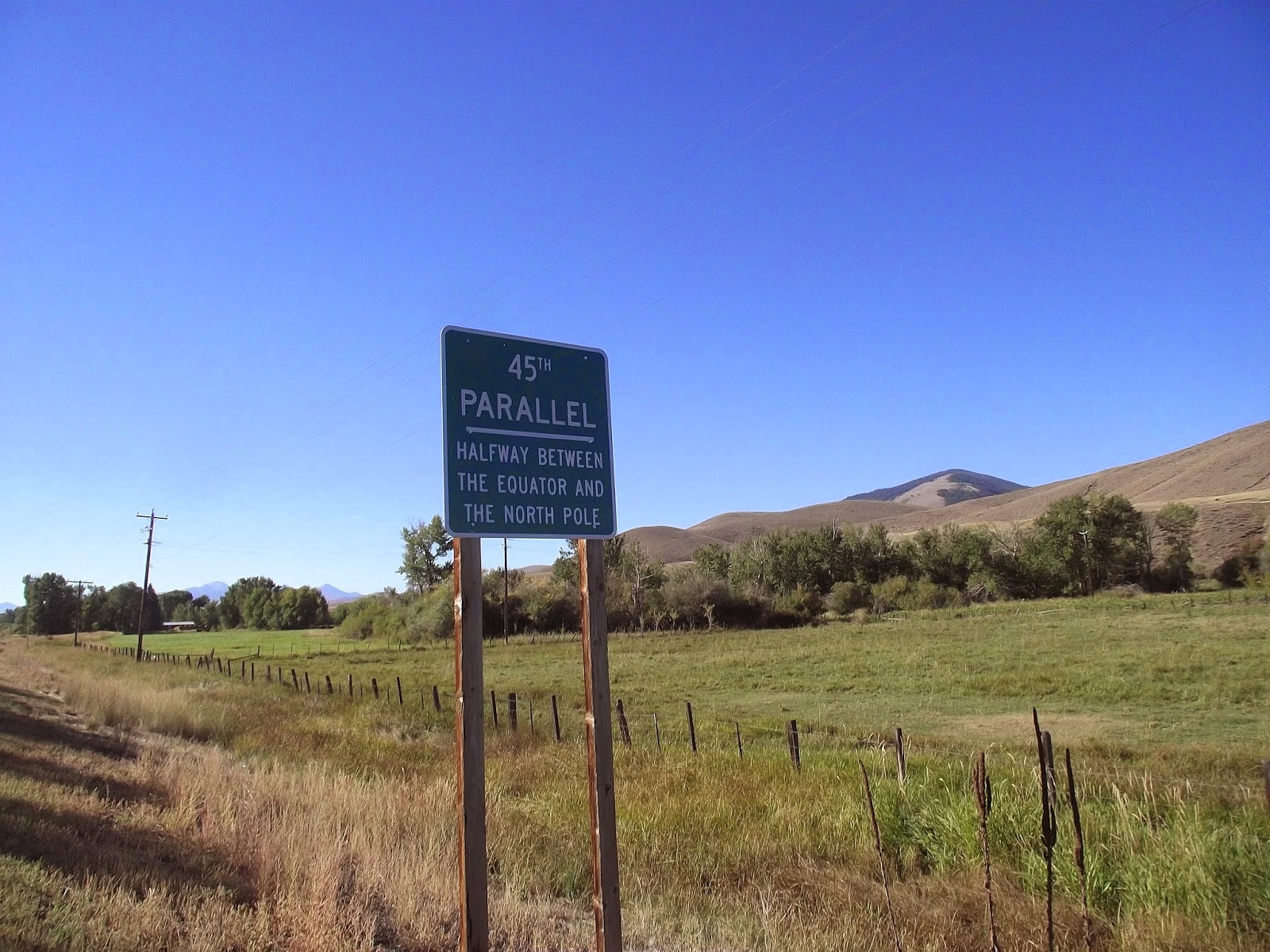
above. In a few miles, I came upon a sign marking the 45th parallel
— exactly halfway between the equator and the North Pole. It brought me back to
childhood summers in Rangeley, Maine, which happens to be at the same latitude
and has a colorful sign up outside of the Pine Tree Frosty to mark the
invisible line.
While Rangeley
was a couple thousand miles to the east of me, I was excited to pull into
Salmon, Idaho, which I’d already heard stories about over the summer.
Specifically, I’d heard about the Salmon River, a.k.a The River of No Return,
with its hardcore whitewater. I’d join fellow raft guides around someone’s
laptop and watch hours of rafts and kayaks going up against the massive waves,
rocks and keeper holes, often getting stranded, flipped and generally
carned-out by the river’s fury.
I counted down
the mile marks to Salmon with growing anticipation. My priorities included
buying some real food at a grocery store, and maybe grabbing some Internet time
for myself as well.
Going back on
the busy roads was a bit of a shock after having minimal traffic for over a
hundred miles. Cities also tend to have steeper hills than wussy highway
grades, so I found myself puffing hard to get to the supermarket, which was
maybe a hundred feet of climb from the river in the center of town.
 |
| I'm always crossing the line |
I loaded up way
more food than I needed and set off for a quiet riverside park where I could
gorge myself in peace.
I discovered
that my brakes were getting worn when I went back down the hill and found that
it took much longer than it should have to come to a complete stop at an
intersection. It occurred to me that this might be something I’d want to look
at before I went down the next mountain pass.
That was, if I
could make myself stay in town that long.
Being amongst
civilization again was disorienting rather than reassuring. Suddenly, I
couldn’t just take a leak wherever. I had to worry about colliding with people
and vehicles again. I felt self-conscious about my oddball bike rig with all
the gear hanging off as well as my scraggly appearance. I sat alone at a picnic
table by the river where I ate more food than most people go through in a day.
It was about 45
miles to reach the Montana border in the north. I didn’t know if I’d be able to
make it over the 7,000-foot Lost Trail Pass that day, but I was already feeling
restless with the time that I’d spent in town. I decided to skip the library or
finding a good bike shop in town. It could wait until Missoula.
 |
| Salmon River, looking north toward the Bitterroot Mountains |
I left town
under a broiling sun, feeling bloated and lethargic after the picnic table food
binge.
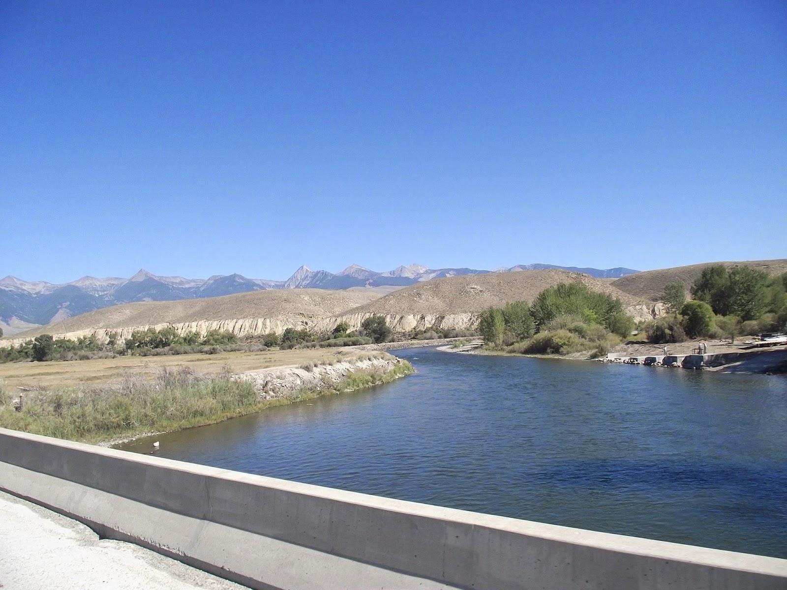
The Salmon
River was a beautiful traveling companion. It wound blue and sparkling through
the dry hills and canyon cliffs. I’d see fly fishermen here and there standing
out in waders. One thing I didn’t see was Epic River Carnage: no massive
standing waves or homicidal cataracts. The most adrenaline I could see in this
section was little fast water riffles, which would barely make Class I.
Every once in a
while, I’d see the familiar sight of a trailer loaded down with rafts, but none
of them were in the water. The good stuff must have been somewhere else.
 |
| Landscape shot near the Salmon River |
My showdown
with the Bitterroot Mountains started with a gradual incline on the way to Lost
Pass at the Montana border. For several miles, I kept going up steadily. I
stopped at a couple historical signs to catch my breath and get water. The
Lewis and Clark Expedition had been in the neighborhood when they’d crossed the
Continental Divide. Being on a known map and more or less contained within
civilization, I felt a bit coiffed compared to these grizzled historic
forebears. No doubt, Meriwether Lewis had smelled a fair stretch worse than I
did at this point in his expedition.
Camping looked
like it might be an issue. The road was hemmed in by private summerhouses,
which made me worry about finding find a tent site without trespassing.
The got
steeper, and soon I was in low gear standing up on the pedals. The road
switched back again, and again. When was I going to be in Montana?
As tired as I
was, I still thought I might be able to crank it the rest of the way up the
pass by nightfall. I even went past a turnoff to a national forest campground
so that I could make more distance. After a couple more miles of grinding
uphill struggle, I decided that Montana could wait another day. I'd done close to 80 miles.
The best place
I could find that wasn’t on an impossibly steep slope or in someone’s backyard
was a patch of forest in the edge of a new subdivision. I dragged my bike over
a guardrail and guided it past the trees with plastic ribbons around their
trunks. In another year, my tent-site might be the living room for yet another
roadside mcmansion.
I started the
next morning with a five-mile grind up to the 7,000-foot Lost Trail Pass into
Montana. Each time I got to the top of a switchback, I expected to see the top
— only to see more road winding up ahead of me.
Several drivers
coming down from Montana shot me thumbs-ups and gave me inspirational honks. It
was late morning by the time I reached the crest of the hill.
There was a
visitor station and a small ski resort set up on the border. If I’d have wanted
to bike a couple miles out of my way, I could have made it to the Continental
Divide, but decided I’d rather use that time to get closer to Missoula, which
was 90 miles to the north.
One important
priority I took care of was checking my brakes. I adjusted the clamps so that
even if they weren’t the best, they would put out enough drag so I could slow
down and steer myself out of trouble. I practiced stopping a couple times, took
a deep breath, and then started down the other side of the pass.
 |
| Finally! |
The rhythm of
the wheels turning blurred into a constant thrum and I felt my eyes tearing up
in the wind. I didn’t turn a pedal, but every muscle was clenched as I flew
down the curves. It was awesome.
I tried to use
the brakes as little as possible. I leaned hard on the curves (though maybe not
as hard as I would have if I’d been riding without gear.) Sometimes, I let
myself drift over center line in order to make a turn. Every gram of my
concentration was locked on the asphalt stretch in front of me, the dashes on
the pavement coming at me slowly at first, than speeding up, finally rushing
past in a blur of gray and yellow.
The mountain
forests gave way to farmland. I’d gone through 10 miles without pedaling a
whit. The next four miles were a more gradual downhill and I barely worked at
all.
The road eventually
flattened out to a scenic ride along the Clark Fork River. The Bitterroot
Mountains towered to the west.
One thing that
I wasn’t a fan of was the traffic. Vehicles coming and going from their ranches
and vacation houses flew by my left side. There was precious little margin to
work with and it cut into my enjoyment.
As I worked my
way further north, I found bigger towns with strip malls and cars backed up
with stoplights.
Fortunately,
there was an intermittent bike trail that let me avoid some of the mayhem. Even
so, I found a tough wind that started shoving me around. I started to slow
down.
It got later
and later in the afternoon, and all I could find was commercial development and
nothing that was available for camping without going way off course. It'd been about 85 miles so far. I was so
tired that it was turning into a colossal effort just to go another mile
 |
| Bitterroot Mountains as seen from Montana |
Finally, I took
a road to a recreation area in a canyon to the west. There was no camping
allowed, a sign explained. Well, screw it.
I trundled my
bike up steep bluff where I hoped it would stay out of sight and set to getting
my tent set up. Of course, as soon as I set to work, I saw a couple hikers
coming down the other side.
I sort of
shrugged my shoulders at what I was doing. They moved on. I didn’t think they
were about to turn me in.
Finally, I
threw my bag inside my tent and fell into the sleep of the dead.
 |
| Camp: undisclosed location, south of Missoula |
No comments:
Post a Comment