Thursday, March 20, 2014

The Day I Should Have Had In Missoula


The University of Montana M as seen above campus. This photo is not from my bike trip, but rather from my earlier visit to Missoula. You don't get to see any new pictures of Missoula because my camera got busted.
The day I should have had in Missoula would have started with me waking up to a perfect sunrise above my campsite, not a freezing fog.
If it were that perfect day, I would have pondered the ethereal beauty of the moment and felt reassured that my bike trip was a chance to reconnect with simple pleasures that most people divorce themselves from as they go about their day-to-day lives.
Then I would take my camera out from a dry place, where it hadn’t been drenched by rain that soaked into my partially collapsed tent, to take a memorable picture of the moment. If it had been my perfect day in Missoula, my camera wouldn’t have been busted forever, and I would have plenty of stunning pictures to post from the rest of my trip.
On the day I should have had in Missoula, I would have cooked myself a hardy breakfast off my stove, not  grudgingly swallowed peanuts and bread. Nor would I have dreaded the 20-something miles I had to pedal to get into town.
No. On my perfect day in Missoula, I would have felt energized and inspired by the distance I’d traveled so far.
Both my real and ideal days share my goal of kicking back a little. I'd  have a beer with a good plate of food and mingle with those fixie-riding hipsters who populate the town, even if I'd normally ridicule them for being fixie-riding hipsters.

Both my fantasy day in Missoula and the day I actually had would be colored by the fact that this was a place I’d visited senior year in college when my thesis on contemporary Irish lit was the center of my world. I got a free ticket to present my work at the National Collegiate Undergraduate Research convention at the University of Montana.
Right after I finished speaking, I decided to do the hike up the hill to the university’s famous concrete “M.” Then I kept going to the top of the 5,000-foot Mount Sentinel in my khakis, tie and loafers. It hadn’t been so great for the clothes, but it’d been a great time.
If I’d had my perfect day in Missoula, I’d have done the hike again just for kicks, not call it off on account of rain and that I had other stuff on the to-do list.

If it had been the day I should have had in Missoula, the county would have finished the bike path going all the way to town and I wouldn’t have ended up riding in the highway margin again with traffic kicking up spray.
If that sounds like too much to wish for, I’ll dial it back and say that I wish I’d shown up any other day of the week but Sunday.
Then when I happened upon the Adventure Cycling Association’s national headquarters on East Pine Street, I would have gotten solid advice about the roads ahead, maybe even bought one of their guides, which would have information about where to camp and other stuff that would have helped in the days ahead.
On my actual day in Missoula, the headquarters was closed, but at least they had a map that listed bike shops and breweries that I could hit in town.
I peddled through the cold and tragically real drizzle to a bike shop that was closed (surprise!) on a Sunday. Another bike shop was open, but not fully staffed for the weekend and didn’t have the time to give to my gears, squeaky axle and worn-down brakes.

On my perfect day, I wouldn’t have lost my balance at an intersection and struggled to pick my fully-loaded bike off the pavement in front of cars at a green light.
Hipsters wouldn’t be able to pedal bicycles faster than me.
I would get a beer and sit outside in warm weather, not shivering inside drinking my beverage out of a sense of duty as opposed to real pleasure. The place would have served delicious French fries and veggie burgers — not just bar peanuts, which I shoveled down in vast quantities anyway.

I would have stayed in town if it had been my perfect day. I might have dished out the money to be at the local KOA, maybe couch-surfed somewhere.
Even if I had left town, I wouldn’t have taken a wrong turn that lead to an on-ramp for I-90, then said “the hell with it,” and ended up peddling four miles in the break-down lane of a busy thoroughfare.
It wouldn’t have been getting dark as I was climbing that massive hill into the Flathead Reservation. It wouldn’t have been pitch dark when I got into Arlee. I would have bought some blinking gear at one of the bike shops so cars would see me. I wouldn’t have had to pedal two more miles on the dark road before I got to the campsite.
I wouldn’t be so negative all the time.


Even though it wasn’t my perfect day in town, the following was kind of cool:

*A bunch of people in their early twenties cheered for me when I was on the bridge above the Clark Fork. “We saw you in Darby yesterday man! Keep going! You rock!” I went a high-five that almost swerved me into the path of an oncoming van. It was pretty sweet.

* The Adventure Cycling Association did leave useful paper maps for visitors. I used mine to find the brewery and try (unsuccessfully) to get my bike fixed up.

*Though I might have enjoyed the beer more in better circumstances, it was still the best I had on the trip that far. (The other beer was the baby spit lager I’d drunk in Idaho.)

* A guy in a car gave me a thumbs up as I was climbing uphill toward the Flathead Reservation.

* I arrived at camp late, but no-one ran me over. I was a big fan of the warm showers and that no one was up collecting fees at that hour.

Monday, March 17, 2014

Across the Bitterroots


Moon over my camp south of Lost Trail Pass

I didn’t feel half bad considering that I’d pedaled 100 miles the day before.
It was another shivery morning, but I was able to spare myself some suffering by warming my hands in an electric drier inside the camp bathroom. Spoiled.
I definitely felt stiff as I got back on the bike but the air was invigorating. The road followed a riparian zone of trees and farmland below the sparse, arid hills above. In a few miles, I came upon a sign marking the 45th parallel — exactly halfway between the equator and the North Pole. It brought me back to childhood summers in Rangeley, Maine, which happens to be at the same latitude and has a colorful sign up outside of the Pine Tree Frosty to mark the invisible line.
While Rangeley was a couple thousand miles to the east of me, I was excited to pull into Salmon, Idaho, which I’d already heard stories about over the summer. Specifically, I’d heard about the Salmon River, a.k.a The River of No Return, with its hardcore whitewater. I’d join fellow raft guides around someone’s laptop and watch hours of rafts and kayaks going up against the massive waves, rocks and keeper holes, often getting stranded, flipped and generally carned-out by the river’s fury.
I counted down the mile marks to Salmon with growing anticipation. My priorities included buying some real food at a grocery store, and maybe grabbing some Internet time for myself as well.
Going back on the busy roads was a bit of a shock after having minimal traffic for over a hundred miles. Cities also tend to have steeper hills than wussy highway grades, so I found myself puffing hard to get to the supermarket, which was maybe a hundred feet of climb from the river in the center of town.

I'm always crossing the line
I loaded up way more food than I needed and set off for a quiet riverside park where I could gorge myself in peace.
I discovered that my brakes were getting worn when I went back down the hill and found that it took much longer than it should have to come to a complete stop at an intersection. It occurred to me that this might be something I’d want to look at before I went down the next mountain pass.
That was, if I could make myself stay in town that long.
Being amongst civilization again was disorienting rather than reassuring. Suddenly, I couldn’t just take a leak wherever. I had to worry about colliding with people and vehicles again. I felt self-conscious about my oddball bike rig with all the gear hanging off as well as my scraggly appearance. I sat alone at a picnic table by the river where I ate more food than most people go through in a day.
It was about 45 miles to reach the Montana border in the north. I didn’t know if I’d be able to make it over the 7,000-foot Lost Trail Pass that day, but I was already feeling restless with the time that I’d spent in town. I decided to skip the library or finding a good bike shop in town. It could wait until Missoula.

Salmon River, looking north toward the Bitterroot Mountains
I left town under a broiling sun, feeling bloated and lethargic after the picnic table food binge.
The Salmon River was a beautiful traveling companion. It wound blue and sparkling through the dry hills and canyon cliffs. I’d see fly fishermen here and there standing out in waders. One thing I didn’t see was Epic River Carnage: no massive standing waves or homicidal cataracts. The most adrenaline I could see in this section was little fast water riffles, which would barely make Class I.
Every once in a while, I’d see the familiar sight of a trailer loaded down with rafts, but none of them were in the water. The good stuff must have been somewhere else.

Landscape shot near the Salmon River

My showdown with the Bitterroot Mountains started with a gradual incline on the way to Lost Pass at the Montana border. For several miles, I kept going up steadily. I stopped at a couple historical signs to catch my breath and get water. The Lewis and Clark Expedition had been in the neighborhood when they’d crossed the Continental Divide. Being on a known map and more or less contained within civilization, I felt a bit coiffed compared to these grizzled historic forebears. No doubt, Meriwether Lewis had smelled a fair stretch worse than I did at this point in his expedition.
Camping looked like it might be an issue. The road was hemmed in by private summerhouses, which made me worry about finding find a tent site without trespassing.
The got steeper, and soon I was in low gear standing up on the pedals. The road switched back again, and again. When was I going to be in Montana?
As tired as I was, I still thought I might be able to crank it the rest of the way up the pass by nightfall. I even went past a turnoff to a national forest campground so that I could make more distance. After a couple more miles of grinding uphill struggle, I decided that Montana could wait another day. I'd done close to 80 miles.
The best place I could find that wasn’t on an impossibly steep slope or in someone’s backyard was a patch of forest in the edge of a new subdivision. I dragged my bike over a guardrail and guided it past the trees with plastic ribbons around their trunks. In another year, my tent-site might be the living room for yet another roadside mcmansion.

I started the next morning with a five-mile grind up to the 7,000-foot Lost Trail Pass into Montana. Each time I got to the top of a switchback, I expected to see the top — only to see more road winding up ahead of me.
Several drivers coming down from Montana shot me thumbs-ups and gave me inspirational honks. It was late morning by the time I reached the crest of the hill.
There was a visitor station and a small ski resort set up on the border. If I’d have wanted to bike a couple miles out of my way, I could have made it to the Continental Divide, but decided I’d rather use that time to get closer to Missoula, which was 90 miles to the north.
One important priority I took care of was checking my brakes. I adjusted the clamps so that even if they weren’t the best, they would put out enough drag so I could slow down and steer myself out of trouble. I practiced stopping a couple times, took a deep breath, and then started down the other side of the pass.

Finally!
The rhythm of the wheels turning blurred into a constant thrum and I felt my eyes tearing up in the wind. I didn’t turn a pedal, but every muscle was clenched as I flew down the curves. It was awesome.
I tried to use the brakes as little as possible. I leaned hard on the curves (though maybe not as hard as I would have if I’d been riding without gear.) Sometimes, I let myself drift over center line in order to make a turn. Every gram of my concentration was locked on the asphalt stretch in front of me, the dashes on the pavement coming at me slowly at first, than speeding up, finally rushing past in a blur of gray and yellow.

The mountain forests gave way to farmland. I’d gone through 10 miles without pedaling a whit. The next four miles were a more gradual downhill and I barely worked at all.
The road eventually flattened out to a scenic ride along the Clark Fork River. The Bitterroot Mountains towered to the west.
One thing that I wasn’t a fan of was the traffic. Vehicles coming and going from their ranches and vacation houses flew by my left side. There was precious little margin to work with and it cut into my enjoyment.
As I worked my way further north, I found bigger towns with strip malls and cars backed up with stoplights.
Fortunately, there was an intermittent bike trail that let me avoid some of the mayhem. Even so, I found a tough wind that started shoving me around. I started to slow down.
It got later and later in the afternoon, and all I could find was commercial development and nothing that was available for camping without going way off course. It'd been about 85 miles so far. I was so tired that it was turning into a colossal effort just to go another mile

Bitterroot Mountains as seen from Montana
.
Finally, I took a road to a recreation area in a canyon to the west. There was no camping allowed, a sign explained. Well, screw it.

I trundled my bike up steep bluff where I hoped it would stay out of sight and set to getting my tent set up. Of course, as soon as I set to work, I saw a couple hikers coming down the other side.
I sort of shrugged my shoulders at what I was doing. They moved on. I didn’t think they were about to turn me in.
Finally, I threw my bag inside my tent and fell into the sleep of the dead. 

Camp: undisclosed location, south of Missoula

100-Mile Push for Salmon

The road toward Salmon going through the Idaho National Laboratory (Sept. 2013)

My hands were so cold I could barely make myself enjoy the sight of the sunbeams playing along the mist rising off the Snake River nearby.
It was another shivery, dew-drenched morning. I walked out onto a dock, dipped my pot into the fetid water with its gray floaties and set about making oatmeal. My numb fingers barely worked the stove.
If there was something to be grateful for, it was that there was no wind. It would be relatively flat going today. With any luck, I would be able to make a good part of the journey to Salmon, Idaho, another 145 miles ahead of me. Towns, camping and water would be few and far between.

I pedaled out from my campsite wearing several layers and heavy mittens, peddling hard for warmth. I veered across some railroad tracks and through the tiny burg of Roberts, Idaho where I’d bought beer the day before.
A mile later, I went over I-15. A local had suggested some back roads that I could take north, instead of peddling in the highway breakdown lane. The route didn’t appear on my map, so I was going on faith that I would eventually intersect Highway 28 after 12 miles and be on the right track.
The landscape was farm after farm, most of it had been harvested recently, so they were acres of nubs. 20-foot stacks of straw bales flanked the massive parcels, like buttresses against an attack. I could look across the fields to the traffic on I-25. Beyond lay snow-capped mountains to the northeast.
Hawks wheeled in the blue sky, searching for voles or field mice.

Tent site by the Snake River
By the time I hit Highway 28, I was feeling warmed up and in a pretty good groove. The sun chased off the morning chills as it climbed higher. I flew past Terreton without stopping, but pulled up at a convenience store in Mud Lake to refill water and satisfy a junk food itch.
Only a week into my trip, I was already beginning to develop a disturbing pattern around gas stations. It was easy to leave my bike unlocked outside where I could see it, go in and spend cash on some plastic-wrapped commodity, bombing my body with simple sugar and fat. Usually the stuff was overpriced too.
Even when there was a supermarket on the relatively isolated route I’d chosen, such stops cost time. I felt wary about leaving my bike with the tent and other gear outside.
Convenience stores, with their ease of access and ready supply of quick, prepackaged foodstuffs were the go-to.
Long miles have a way of building up an insatiable desire for industrial, extruded polymers like Oreos or Twizzlers. Some of this can be explained by the fact that burning mad calories on the road, lends itself to a craving for the most calorie-dense foods available. That isn’t the whole story though. No, I was trying to fill something.
There were the lonely hours at the pedals with no company but my bored and often restless mind. The satisfaction of a good day of biking is hardly a guarantee; not like the guaranteed sugar rush and endorphins from that first slug of Dr. Pepper — however fleeting that satisfaction might be.
Even walking among the store shelves with their flashy colors and dazzling variety was a kind of escape, a denial of the austere nature of my journey. The fact that I got so caught up in this, speaks to the fact that I was going about something wrong. I wasn’t keeping my mind on the ride. I believe that giving up comforts and finding the strength to thrive without them is an important part of adventure. Yet, every day I undermined the sacrifices made on the trip stuffing my face full of soul-drugging crap straight out of the bowels of commercialism.
The question was whether I could ride beyond the gravitational pull of these desires, or whether such needs would begin to accumulate around me like dead weight until they finally dragged me down to right where I started.

When it came to weight, I decided to revisit my original model where I took my dry bag off my back and strapped it to my backboard with the rest of the gear. Though this meant more risk of weaving, I figured it was an acceptable trade for the flat, empty stretch that lay ahead.
It was one of those infinite desert roads that stretches straight out to the vanishing-point on the horizon and summons all those Americana fantasies about the open highway. Two desiccated mountain ranges rose up on either side, the faintest hint of snow around the tall peaks. It was maybe 100 more miles to Salmon. There wouldn’t be so many distractions for a while.

One constant companion that joined me somewhere around the Idaho border was the squeal of my front axle. Even after I applied graphite lube the night before, it continued its loud, high pitch shrieking as I went along, like a dull blade bearing down into my sanity.
Another mechanical woe was the fact that I could no longer get into my highest gear. Every time I made the last shift, the chains made pissed-off grinding noises and the pedals spun around helpless.
I’ll be the first to admit that going into this trip with more bike mechanic knowledge would have been an unquestionable improvement. As it stood, I figured I was better off on a noisy bike that I could pedal pretty well, than screwing around with it and making things worse in the middle of nowhere.

Shifting all the weight to the back of my bike was great as far as my spine was concerned, not so great when it came to the risk of flipping ass over tea kettle and getting flattened by an oncoming semi. I focused on mitigating the bike’s desire to wobble and cause trouble. The gear was obviously uncomfortable jammed together on the backboard and wanted to slide to one side or the other. Much as I wanted to make adjustments, I also knew it would be a colossal pain to stop peddling, find somewhere to lean my rig and do the necessary tweaks. To slow down was to lose control, and this kept me peddling steadily for many miles.
 Not that there was anywhere to stop. Both sides of the highway belonged to the Idaho National Laboratory — a facility for nuclear research amongst other things. Not surprisingly, this land was off limits for camping.

I refilled water again at a small convenience store that may have been the only reason why there was a town on the map. I bought a hit of Fritos too.
Whether I was traveling in the right kind of Zenned-out bliss or no, one thing for certain was that I was kicking ass in distance with 70-something miles down by mid-afternoon. A bit of tailwind helped considerably, so did my frustration about the pathetic 30-mile day from earlier.
The town of Leadore was in 30 miles, a sign announced. I figured I’d camp somewhere in the backcountry before that, then go the rest of the way to Salmon on the next day. The thing was that I was feeling uncommonly good. I powered up a gradual incline to the 7,186-foot Gilmore Summit, where I put my dry bag on my back again, then I flew down the other side — drunk on gravity and the wind on my face. Even so, I knew it wouldn’t last forever. My legs were already tired, and were bound to ache like a mother later that night.
I kept seeing great places to camp and kept passing them. The mile markers kept putting me closer to Leadore, which would be just about 100 miles from where I’d started peddling that morning. Maybe I’d camp at the other side of town.
So it might have been had it not been for the $5 camping spot in the center of the town. I looked at the freshly mown lawns, thinking about how nice it would be to have water and all the other conveniences right next to me. Still, I could be the badass who did more than 100 miles and still slept on a bed of gravel. I leaned against a picnic table, caught up between whether I should peace out or pitch tent. The camp owner came out and I finally decided on the latter.
They had showers.

Bike portrait at Gilmour Summit

Tuesday, February 25, 2014

Tailwind, Headwind


Good morning Idaho
The howls of the coyotes drifted through the pines at night.
I awoke around sunrise in my makeshift campsite at the edge of the Bridger-Teton National Forest and thought about the day ahead. The first priority was to get some tent poles so I wouldn’t have to rely on trees to rig my tent. I planned to go north through Afton, Wyo., then cross back into Idaho to make camp. From there, I’d head north of Idaho Falls and on to Salmon and eventually Missoula, Montana.
That was still hundreds of miles ahead of me.
I carried my bike out of the trees, got loaded up, and bumped down the potholed forest road to the main highway.
I flew on a downhill for several miles getting chilled from the morning air rushing by me. The sun climbed above the undulating hillsides and farmland, casting its golden illumination upon the countryside.

I rolled into Afton, Wyo., which had an enormous bridge made entirely of elk antlers spanning Main Street. It was the largest of its kind in the world, a sign announced.
There was a place downtown that sold sets of tent poles. I guestimated how many I’d need by measuring off lengths with my arm and determined I’d need to buy two sets in order to reconstruct my earlier setup. If my future self from several hours later could have reached me then, he would have begged me to buy one more.
Afton

Unaware of my error, I merrily peddled out of town on a long stretch of downhill. The beautiful morning gave way to dark clouds. Then rain. The hail, flung into my face by the wind. Well, what else would you expect from Wyoming?
My progress slowed to a bitter crawl. The more I fought, the more fury nature flung against me. I was sick of it. Eventually, I wheeled into the tiny town of Etna where I ducked into a coffee shop to take a break and suck down a Red Bull (when did I start drinking that swill anyway?).
The weather cleared, but I was still exhausted after the fight. I made another stop in Alpine by the Snake River. One road went north to Jackson, the Tetons and Yellowstone, the other went to Idaho. Tempting as it was to take the north road through some of my favorite landscapes, I resolved to head west toward Idaho Falls which was the faster route and also new territory for me.

The storm that chased me into Idaho
As I loitered outside a gas station, I felt a strong wind out of the east. A line of storm clouds was coming at me from that direction. I remounted my bike and started peddling west for all I was worth.
I didn’t hold much hope for beating the storm, but figured it would be worth it to try for a couple miles before the downpour.
One thing that I had in my favor was that the wind was going my way this time. I flew past the Idaho border and along the line of an immense reservoir. There was new energy in my legs as well. I flew effortlessly up and down hills, using the storm’s energy to keep away from it. There were several downhill straight-aways after the reservoir that gave me even more speed.
Thirty miles outside of Wyoming, I began to tell myself that I might have actually beat the storm, which had fallen a good distance behind me. All around me, fields of grain soaked in the sunlight. There were still boaters on the Snake River nearby. 
Then I started climbing a massive hill. At the crest, I saw a new thundercloud coming from the west, raking the landscape with dark bands of rain. What the hell?
 Lightning flashes cut across the sky and boomed across the empty fields. I realized that I had minutes to spare if I wanted to get the tent set up. So, I probably wouldn’t to have the time to assemble the tent poles properly. I flew down a mile of road with the storm looming larger and larger in my sites. Everything looked like private farmland and was wide out in the open. Finally, I veered down a cobbly road and into a small depression beneath some cottonwood trees.

I didn’t have time to put the string through all the poles, so I just fitted them together, counting on the torque between the bendy rods to hold the structure in one piece. That part worked.
What didn’t work was that I had grossly underestimated just how much tent pole I really needed. By the time that the rods bent upwards, I barely had five feet of tent at the bottom.
I kept the poles in place by stabbing them right into the soft ground and curled into my undersized structure, waiting for the downpour.
When the rain didn’t come immediately, I decided to move my tent back a bit to where there were some trees and I could build myself some more ground space with rope. This I accomplished, but it was a pretty crappy sight.
 The first droplets began to spatter, and I closed my eyes, praying that the next day would be dry weather.

The next morning was sunny, but cold and windy as all hell.
There were only a couple miles to get to Rigby, Idaho, but it took hours of fighting the wind. I hopelessly shoved my bike against the air, barely making managing a walking pace.
Rigby has the dubious distinction of being the fist community in the United States to have television. It did however have a fine library, which I used to check email, refill water bottles and try to plot a route through the suburban sprawl around Idaho Falls. I also found another store that sold tent poles, so that crisis was averted for the time being. Now the question was if there would be anywhere to pitch the thing.
Being near a big city is worrisome because it means that camp spots are few and far between. I didn’t see any public land on the maps, and figured I’d either have to peddle many miles until I reached public land or just wing it somehow.
When I got back on the bike, it was still the same discouraging struggle against wind. I was glad that I didn’t have a speedometer on my bike, because otherwise I might have lost my mind when I saw I was going four miles an hour across the countryside. At least with hills, I knew that I would get to go down at some point. The headwind in my face offered no such relief.
Even more maddening was the fact that I was surrounded by bland pastures and suburban houses. As I strained with all my will against the elements, other people were going about their ordinary lives, driving in cars, vaguely aware that it was a bit breezy outside.
I’d barely made it nine miles out of Rigby when I saw a small municipal campsite by the edge of the Snake. I’d planned for big miles that day, but I was sick of giving everything I had and getting almost no miles in return.
I pitched my tent  a couple of feet away from the parking lot and cracked a beer that I had bought from a convenience store nearby. The room temperature can had the taste and feel of baby spit, but I was even more disgusted when I opened my atlas. I’d barely made 30 miles. It had been a helluva day.


Friday, January 31, 2014

Fossils, Coke and Idaho


I slept an uncomfortable night on the hillside west of Kemmerer inside my flattened tent.
A tent without its poles is a crappy shelter indeed — especially when there are no trees around to prop it up on I would have just set my sleeping bag up without it, but there were some clouds on the horizon and I worried they would bring rain. To add protection against this, I attached the rain fly as well. It sat on top of my nose, pooling condensation from my breath onto my face. My backpack stayed in the tent next to me in the hope of propping up a little air space, but it still felt like I was smothering.
Eventually, I unzipped the door and ended up sleeping with my head outside and the full moon in my eyes.
When I woke up the next day, I saw that I’d managed to wriggle myself half out of the nylon cocoon to metamorphose into a grimy dude sprawled out on the gravel, wet with dew. Thank God it hadn’t rained.

My first priority was to find water. There were some puddles in the fields of muck and cow droppings beneath my hill, but I decided to pass. It was only a couple more miles to the turnoff to Fossil Butte National Monument, which was bound to have some kind of water fountain or at least a bathroom sink. It would be trouble if there weren’t because I didn’t see any streams, rivers or any major towns on the map for at least another 20 miles.
I got my gear together and started peddling west. The turnoff for the monument showed that the visitor center was 3.5 miles off the main highway. My heart dropped.  I’d be adding seven miles of peddling to my trip because I saved two miles of peddling by not going into Kemmerer to fill my bottles the day before.
Nonetheless, I didn’t want to try a dangerous experiment with dehydration by peddling into the heat of the day without water. I groaned and started biking into the monument. There’d better be some damn good educational displays here, I thought.
There were markers along the road showing the history of life on earth. As I labored up the hill, I moved through the origin of eukaryotic bacteria, the formation of multi-cellular organisms, the colonization of land and the rise of the dinosaurs.
The visitor center had some nifty fossil displays with explanations of geological events that happened amongst the barren desert landscape outside. I filled my bottles at a fountain and then bought a couple post cards, which I filled out on the balcony.
If there had been more time, I’d have liked to have checked out some of the trails in the area, but I was determined to put some miles. I asked one of the rangers if I could get back to the highway without having to retrace my steps, and she said that I could save some time by making a right turn onto the frontage road which reconnected with Highway 30 a couple of miles further west.

I cruised downhill out of the monument, then peddled along a beautiful country road for a few more miles. Sure enough, it took me right back to the highway. There was a long, gradual downhill, that made the miles fly by. I left the buttes and ended up on a flat plain of golden pasture baking beneath the blue sky.
I noticed that the road was going uphill, ever-so-slightly. A hot wind blew into my face. Now I wasn’t going so fast. Several times, my concentration slipped and the wheels went for a jaw-rattling ride over the rumble strip. If I’d learned anything from this trip so far, it was that rumble strips are a royal pain in the ass when you’re on a bicycle.
My first town that day was Cokeville, part of the proud western tradition of naming towns and counties after whatever gets mined there (See Carbon County, Wyo. and Utah; Telluride, Colo.; Gold Bar, Wash.; Radium, Colo.) — the fallback option when they run out of names of white guys who killed Indians (See Sheridan, Wyo.; Crook County, Wyo.; Sturgis, S.D.; Custer, S.D.). Were Cokeville in Columbia, I might have assumed that they mined bales of pharmaceutical-grade cocaine, but of course being Wyoming, the town-name meant that it had been a source of the high-carbon coal used for iron refining.

I set the bike down outside the post office, where I mailed my postcards. I disassembled my stuff and took my soggy sleeping bag out to dry in the heat. The fact that I had no tent-poles was on the back of my mind and I looked for something I could improvise with in the small grocery/hardware store nearby. There was nothing light or versatile enough to be worth carrying on my back. With any luck, I would be camping around trees that night and would be able to improvise something.
I picked up fruit and peanut butter for the eating. A television was blaring reports about a shooting in a navy yard in Washington State. No one was mentioning number of casualties yet.  Soon I would be biking again and it would be at least another day, maybe more before I would get any more word about the tragedy.


I gorged myself on food outside the post office until I felt like I was too bloated to peddle another mile. Too bad. I left town sloshing  and sweating in the 80-degree temperatures. Soon I was incredibly thirsty and managed to drain most of my water supplies in a series of epic swigs. I watched some farmers harvesting hay in the some fields nearby and almost asked them if I could borrow a hose.
I crossed into Idaho with little fanfare. It would only be about another five miles or so before I crossed back into Wyoming. Still it was the first time I had been in the state, and I was proud to have made it somewhere completely new under my own power.
After I re-entered the Cowboy State, I began climbing a gradual ascent into the mountains. I was a bit thirsty, but found a bunch of extra energy from somewhere. Going up the first part of the pass was no problem.
The road paralleled Salt Creek, a potential water source, though I worried that it might actually live up to the name and be too salty to drink. Salt or no salt, there was definitely shit in the water. Herds of sheep were everywhere, even after I entered the Bridger-Teton National Forest.
The sage plains grew up into lofty pines and aspens as I gained altitude.
When I pulled into a campsite nearby, I went to fill my bottles at the pump, only to find out that there were unsafe coliform levels in the water. At that point, I decided that this was the reason why I’d brought iodine tabs with me and used them to purify the water.
I contemplated paying to stay at the campsite, but decided to save money and put in some more miles while there was still daylight and find somewhere off the road where I could sleep.
In the next 20 minutes of peddling the climb got steeper. I cursed when I came to a bend in the road to see the hundreds of feet I still had to climb to get to the top.
      I gritted my teeth and felt my heart pounding in my skull as I forced my legs against gravity. At last, I topped out at the summit of the 7,600-foot pass.
I bombed down the decent, taking turns hard and weaving over the center margin when there were no cars coming the other way. At the edge of the forest, I climbed up a dirt road and made a campsite for myself in the woods.
I used ropes to tie my tent up to several trees and made it into a pathetic, but nonetheless three-dimensional shelter.
There were bears in these woods, so I made sure to hang my food in a tree (though admittedly, a determined bruin might have still been able to snag it), and to sleep with the bear spray close at hand.

Thursday, January 16, 2014

The Storm Chased


Pt. 3 in the Northwest bike series

Clouds move in north of Mountain View 
Whenever I get that feeling that I am forgetting something, I am correct 99 percent of the time.
If only that feeling could help me remember what that I am forgetting. Instead there’s just a vague nag in the back of my mind that serves to aggravate me later when I finally recall the crucial item I was somehow dumb enough to leave behind.

Come on, tell me! What is it? I pleaded with my subconscious.
Oh don’t worry; you’ll find out later, it sniggered.
I got back to organizing my tent and the rest of my scattered supplies in the cow shit scrubland where I’d been camped.
I’d been slow to get moving that morn, though I didn’t regret the warm bowl of oatmeal I’d cooked for myself over the stove. The fact that it was no longer raining and that the sun looked like it might come out lifted my spirits. Yes, it might have taken a  little longer than it should have to get everything packed, but it was only the second night out and I was still getting used to the weird system I’d made for myself.
The part I didn’t like was hauling my bike and all the gear back over the fence. At least one car passed by while I left my illicit campsite, but I just acted cool like I was supposed to be wrestling a bike and a bunch of random gear over the barbed wire.
Soon, I was peddling northwest along the wet asphalt and feeling pretty good.
The wide open rangeland gave way to stands of cottonwoods and other deciduous trees with smaller farmsteads that reminded me a bit of Vermont. The Uinta Mountains loomed up from Utah in the south, including Kings Peak, the highest point in the state. I was rueful at the sight because I’d wanted to climb the mountain that summer, but plans never solidified.
Now, at summer’s end, Kings wore a formidable white crown of snow, perhaps the top 2,000 feet of the 13,000-foot mountain.
It was a reminder that winter was behind me at every step. In the weeks ahead, no doubt the snow would march lower and lower down the mountains until it finally seized the roads and blocked me from going any further.

Nothing says rural American like a fading flag mural by the tracks

The same precipitation that lent the Uinta Mountains their dazzling patina had also completely soaked the land that I was biking over. Every mile or so, I would go by some minor stream, frothing brown with runoff.
The convenience store clerk in Manila had warned me that the road was closed the day before due to flooding. I was lucky enough to get through unobstructed, though I saw road damage in a couple of places.
After the farmland, I enjoyed a long downhill into a vast basin. The landscape was almost Martian. Miles of empty wastes lead up to the foothills of the mountains, populated by the tall buttes of bentonite clay and orange sandstone. An occasional county road or lonely oil derrick were all that would evince a human presence.

I was grateful that it wasn’t actually raining right then, even if the air was still heavy with cold moisture. Only a couple of days before I had finished my rafting season with a rainy four-day trip that left fond memories of numb hands and clutching myself for warmth each night. The same soggy weather patterns were responsible for the major flooding in Northern Colorado that had made national headlines.
Why were the Rockies so drenched right now? I blame it all on Global Weirding: unpredictable climate patterns linked directly to the cowboys driving past me in their jacked up pickups, belching greenhouse gasses into the Wyoming sky.

The town of Mountain View was pretty quiet on a Sunday. I showed up a little before noon and took a quick jaunt down Main Street just to see if there was anything worth seeing. Most of the businesses were closed up. Nearby however, there was a Maverik gas station and convenience store, which provided me with a bathroom and a convenient faucet for filling bottles. I splurged on a box of greasy potato wedges that I ate outside, shivering by a picnic table.
Coming back into civilization is one thing when you have a place to stay, shower off and get into dry clothes. When you are just pushing through, there are fewer comforts. It is easy to become self-conscious when you see people looking at your tattered appearance, the fact that you carry a bag into the store with you or are filling up water bottles. The feeling is that you don’t belong.

 I dug my atlas out from the recesses of the pack and plotted my course to the northwest. It looked like the most direct route took me toward Kemmerer, Wyoming and on to Fossil Butte National Monument. In the little research that I’d done before the trip, I’d learned that while the monument itself is off limits to camping, a lot of the land surrounding it belongs to the Bureau of Land Management, and is fair game. How exciting to think that I might actually camp legally that night.
Back on the bike, I rolled north out of town toward the rolling plains. I went under Interstate 80 with the semis and other vehicles cutting across the country on their east-west trajectory. The artery of United States commerce was soon just a thin gray line in the distance, a filament of asphalt winding over the expanse of sage and cheat grass.
The only thing as vast as the miles of emptiness around me was the sky above it. In the northeast corner of that firmament, I saw tall ominous clouds bearing down on me like Star Destroyers. The dark bands of rain I saw beneath those clouds and the groans of thunder meant that I would soon be in for a cold, miserable time. There was one wild hope, however.  If I peddled my ass off, maybe, just maybe I would get to the north of the system before it rolled across my path.
I started cranking.
The clouds continued their inexorable march in my direction. No way I can beat them, I thought. Might as well just accept fate. I kept peddling anyway, flying over miles of plains and taking advantage of a long downward slope. Then I barreled through a tiny town by the railroad tracks and puffed my way to the top of a steep uphill.
I looked back at the storm. The hard work had put me far enough so that that it would miss me.
The effort was worth it, but for the next miles I was whipped. There was always another damn hill to climb. Soon, I just leaned my bike against a road post and ate a bunch of food to replenish my stores. The long break helped some, but I didn’t have nearly the get-up-and-go that I’d had earlier. The quiet country road I’d been peddling led to a busier state highway leading into Kemmerer. The fact that the road was going slightly uphill was something that I’d probably never notice from behind the wheel of an auto. On a bicycle, it was all I thought about.
I could have biked into Kemmerer and paid tribute to the birthplace of J.C. Penney, but opted to follow a highway that took a more direct route to Fossil Butte. The decision shaved two miles off my course, but it also mean that I wouldn’t get to refill my water bottles at a gas station and would have to wait until I got to the national monument the next day.
I knew I was going to drain my water cooking dinner that night, but decided that it was worth it to save the extra distance — not only for the sake of my legs, but also because I wanted some extra time to find a good campsite before it got dark.
I peddled down an onramp to a divided highway, peddling in the brake down lane as the trucks flew by. The land was similar to what I had camped in the night before with tall barbed-wire fences and wide open expanses where it would be difficult to pitch a tent without attracting attention. Angry signs warned that the land beyond the fence was state property. Violators would be prosecuted.

Moon and clouds above my tentsite

At last, I found a small Bureau of Land Management interpretive area with a tunnel that lead to land on the other side of the train tracks. Here was the legal camping I'd been looking for.
I wheeled my bike through some thick muck beneath the bridge and hid it in some brush. Legal or not, I prefer a discrete campsite so I trudged my gear up a steep hill where I would be out of sight from any passerby. With more ominous clouds on the horizon, I quickly began to set up my tent.
Tent poles! Where the hell were the tent poles?
 I desperately began to search through my gear, though in my heart I already knew where they were. They were some 75 miles back in a rancher’s field just north of the Utah border. At last, I remembered.

Eastbound Union Pacific train coming out of westbound sunset

Saturday, January 11, 2014

The Big Climb: Out From Utah, Into Wyoming.


Capt. Jackass and the Flaming Gorge Reservoir

The cold, gray morning hours were exactly what I needed to wake up feeling uninspired.
The night’s rains had slipped past my cheap rain fly, successfully dampening about a third of my sleeping bag. The tent was a claustrophobic, dripping place, but right then I preferred it to whatever lay outside. Finally, I wriggled my way outside and flopped onto wet clay. 
There was my bike, flopped on its side in the mud. There was the desolated plain of ATV tracks and scrubby juniper that I'd camped in. The low clouds overhead looked like they would be happy to dump some more water on me if they felt like it.
I packed up my gear slowly and with little enthusiasm. I lashed my backpack onto the backboard under a waterproof nylon then hoisted the dry bag behind it.
“Don’t fall.” I told the bike.
The handlebars bucked left and right as I wheeled my bad idea over the dirt ruts toward the pavement. I felt some resistance coming from the back wheel. It was the brake pad. Sonofabitch.

I eased the bike down on its side and used my Allen wrench to let out a little more slack in the mechanism. It took time because the bolt was already pretty stripped. For a while, it looked like I wouldn’t be able to loosen it at all. Besides, this was usually the kind of thing where I just made things worse. Maybe I would just have to peddle back to the bike shop with my tail between my legs. Maybe I would just go back to the car and call off the trip, which had been half-baked from the start.
 But no! After the appropriate amount of turning and threatening the bike, I got the bolt loose enough to pull the cable and guestimate the right distance between the bike pads and the tire. I righted the beast and wheeled it again. It seemed to go OK now, and when I squeezed the brake I found it clenched the tire acceptably.
I put grundle to the seat and started for the pass.


The first quarter-mile was on a downhill. Enjoy it now, I thought. I tried to keep as much momentum up as possible before I took the 90-degree turn onto Highway 191. Within a minute, I was barely managing five miles an hour against the steep grade. I shifted to low gear, forcing my legs to turn the peddles over as my lungs burned for oxygen and my heart pounded in my head.
Each of the many switchbacks in the road took me approximately one lifetime to climb. Every decade or so, I rolled by another dash in the passing lane. A steady drizzle froze my hands to the bars, while I roasted underneath my rain jacket.
Sounds pretty crappy, right?
I didn’t mention that this must have been RV Clusterfuck Day in Utah. Every minute several of these mcmansions on wheels roared up from behind me and flew by in a wash of fumes and destabilizing wind. Also, I was lucky if I had more than 18-inches of breakdown lane at the edge of the road. Not much of a margin for error. It was worse considering that many of the drivers weren’t very interested in moving over.
All the weight on the back of the bike meant that it had a strong tendency to swerve, a tendency that was especially strong on the uphill. Then some retirees in their Wilderness Advantage RV would barrel past, bringing me within inches of a speeding wall of deadly metal. I would clutch the handlebars in desperation, praying that my wheels wouldn’t swerve left. Each vehicle left a vacuum behind it that yanked at my bike toward the center of the road and oblivion.
Finally, the vehicle would pass and I would puff out the breath I’d been holding in. An instant later, Death would get a second swipe at me when the inevitable pickup truck or motorboat pulling behind the first unit flew by.
The road got steeper I was strained to the utmost keeping my bike upright and moving in a straight line. The sound of another engine coming up from behind was like the wasp buzzing in your ear while you’re trying to haul a filing cabinet up a flight of stairs.
Something told me that the driver wasn’t about to make room. The engine grew louder. It sounded like it was headed right for me.
I veered off the road just before the monstrous trailer flew past at top speed. The bike bucked like it was going to veer left, but I fell over instead. I got up shaking with adrenaline. The driver barreled on oblivious, disappearing into the mists above.

This wasn’t working at all.
I looked at my set up, trying to think of something I could change to make things safer.
Finally, I unstrapped my drybag from the backboard and put my arms through the shoulder straps to wear it like a backpack. I didn’t relish the extra weight on my shoulders, but figured that taking some of the weight off the back of the bike would help with stability and steering.
When I got going again, I found the weight put an uncomfortable strain on my back, but I also felt more in control of the bike than I had before.
My heart went like a jackhammer as the wheels slowly carried me up the switchbacks. The fog got soupier; ghostly stands of aspen appeared as shadows in the mist.
I heard a series of moans and bellows from somewhere up above: a cattle herd. The river of bovines clomped along a soggy ridge while cowboys on horses shouted them along. So there was something out there that felt worse than I did.
The long climb topped out at a small rest area. I wheeled over to the outhouse and leaned my bike against it, taking shelter from the drizzle beneath a tiny overhang. The bellowing and clomping of the cattle stayed my ears like a weary dirge. The cowboys guided the sorry lot of them right up to the edge of the rest area and then started herding them across the road. One calf had other ideas and broke out of line, stumbling for the fields. A couple of cowboys spurred their horses and rounded him up.
It must have taken about 15 minutes for the herd to make it across the highway with traffic stopped on either side. Finally, an ATV at the rear ushered the last of the animals across the road. It was time I got going as well.

I peddled slowly out of the parking lot and back onto the road. The bike began to accelerate. I was going downhill! How sweet it was to move without doing work! Soon I was whipping at over 20 miles an hour and freezing cold with the sweat from the last hours evaporating in the wind. The sensation didn’t last. In less than a mile, the road went up again and I was back to working my weary legs against the mountains.
The top of the pass was at 8,422 feet in the midst of a lodgepole pine forest. I had climbed just about 4,000 feet from where I’d started that morning. Now, I could enjoy a long downhill on the way to Flaming Gorge — or would have enjoyed it if not for the icy rain. I flew down the wet pavement, squinting against drops of water and trying hard not to wipe out on the turns.
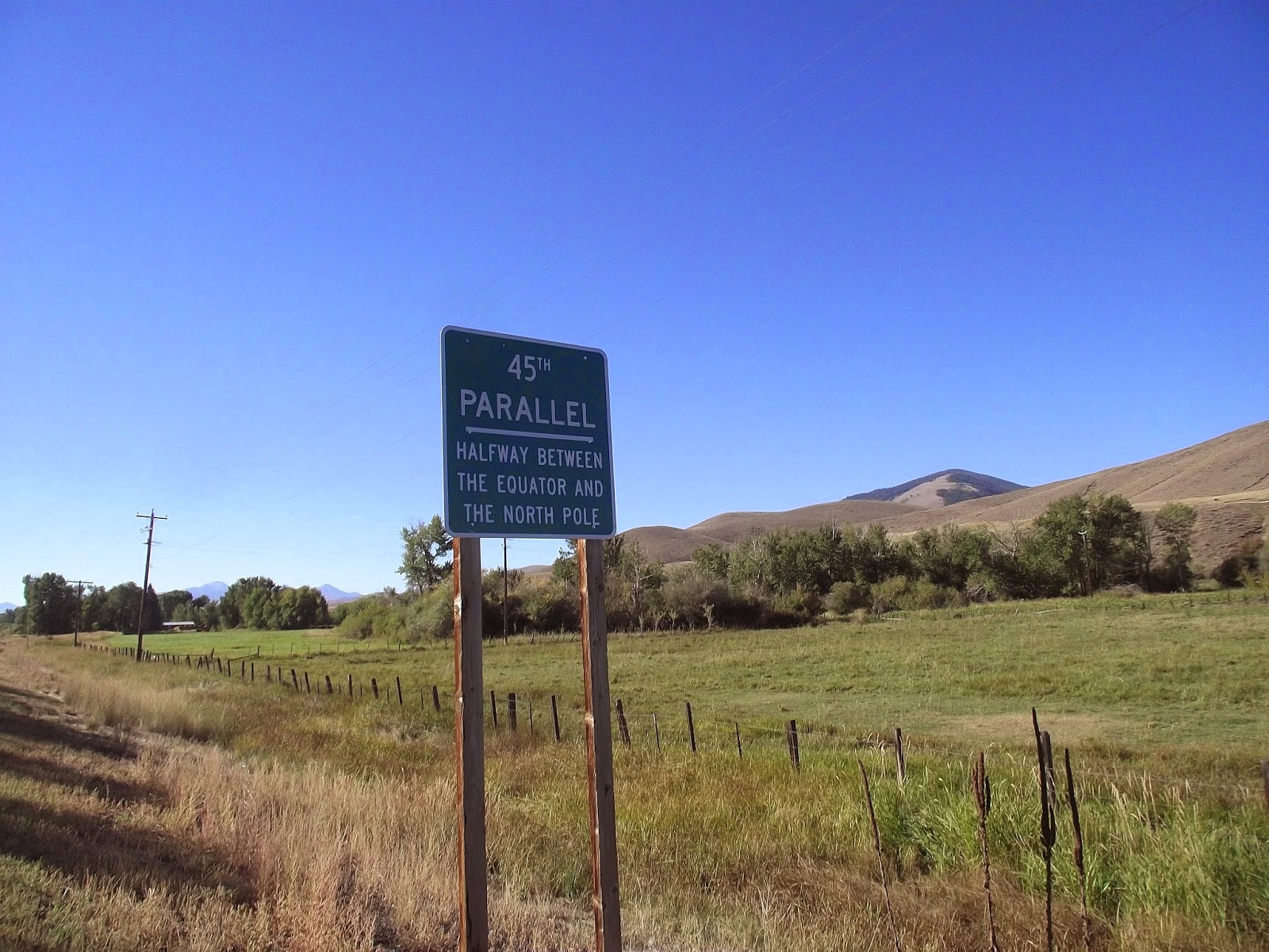
I turned left just before the Flaming Gorge Dam so that I could follow the west shore of the reservoir on the way to Manila, Utah. The town, which sits just south of the Wyoming border, was another 28 miles ahead. My downhill lasted for a couple more miles and then I was going up again. The road never seemed to flatten. First, I would be sweating as I pumped the bike against gravity, immediately after I would be shivering in the wind on the next downhill. 
I took a quick break at Moose Pond to eat lunch and took what warmth I could from a feeble sun breaking through the clouds.

And we go down again
Not long after I got on my bike there was blue sky and the mercury was climbing. Soon it was like any other hot, sunny, summer day. The landscape became dry again as well. The lodgepole forest gave way to fields of sage and desiccated mesas. I forced my way up a 
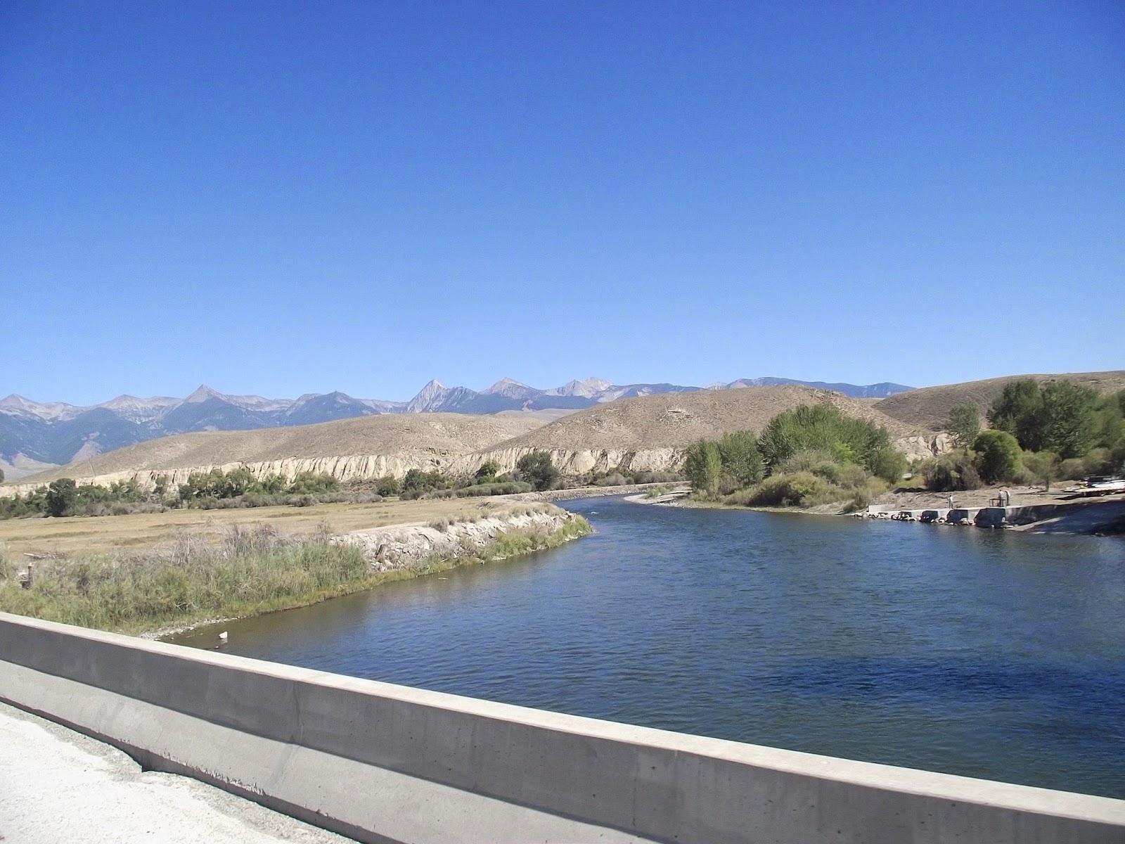
series of massive hills, until I finally came to an overlook. The Flaming Gorge Reservoir lay below, with its dark blue water framed by desert cliffs.
The bike and I flew down a series of switchbacks, losing at least a 1,000 feet in just a couple minutes. It was funny to think that it would have taken me a good chunk of an hour to cover the same distance had I been going in the other direction.
Of course, right after my break, I started into another massive climb. The veins bulged out of my neck as I struggled to keep my momentum. A pack of motorcycles came thundering down the other way. One of them gave me a thumb’s up. I was glad I was doing something crazy enough to be worth noticing.
At the top of the hill, the desert landscape gave way to green, irrigated farm plots. The town of Manilla lay just a few miles ahead, but it took a monumental amount of energy just to drag myself that far.
The sight of a puny gas station convenience store on Main Street was like oasis in the Sahara. I filled my canteens up at a faucet outside and shoved my face with Oreos and Fig Newtons that I bought within.
“Are you ill in the head?” the woman behind the register asked when I told her I was biking from Utah to the Pacific Northwest.


I peddled out of town with rubber legs on an uphill grade. There was a KOA campground nearby. Tempting. If I just paid out the $25, I wouldn’t have to worry about finding a tent site on the rangeland up ahead, most of which was bound to be private property, with few places to hide from well-armed ranch owners.
Still, I was only another four miles to the Wyoming border and I was determined to wake up in the next state, if only to prove to myself that I was making progress. I peddled on.
Dark clouds had gathered in the northeast by the time I crossed the state line. I watched the dark bands of rain with trepidation. Normally, I would expect bad weather to come from the west of me, but this was marching right for me. I needed to get the tent up, pronto.
The problem was that all the land that I could see was wide-open ranch land, within view of the road and the ranch houses up above. Wyomingites are not famous for their love of trespassers.
Tall barbed wire fences cut the land off from the road. It was a super fence with sturdy wire mesh on the bottom and strands of barbs at chest-height. Usually, I see fences that are just three parallel wires and are pretty easy to duck through. This stuff was going to be a challenge.
I peddled furiously for a couple miles, looking for a break somewhere. All I saw were empty plains and the unbroken fenceline. The clouds marched closer. Finally, I saw a small gulley behind a clump of trees: 10 square feet of land where no one would be able to see me. It looked like I’d have to hop the fence after all.
I dismounted and lay my bike behind some sage. Then I tossed my drysack over the fence. Getting myself over was a little more challenging. I climbed the mesh and then grabbed hold of one of the posts for support when I swung my leg over the top. The operation brought my crotch within an inch of the wire skewers. Finally, I landed gracelessly on the other side and went down into the gulley.
Cow shit everywhere. I pitched my tent away from the center of the gulley in the hopes that it would be out of the path of any run off from the storm. If I moved five feet to the left or right, I would be in clear view of the ranch house nearby. I still worried that someone might find my bike near the road so I went back and heaved it onto my side of the fence.
I ran back to the tent and zipped myself into my sleeping bag. Two minutes later it started raining like all hell.


Is there a place anywhere in this view where I won't get shot?

Saturday, September 14, 2013 — about 69 miles